MyTopo
Alvarado Texas US Topo Map
Couldn't load pickup availability
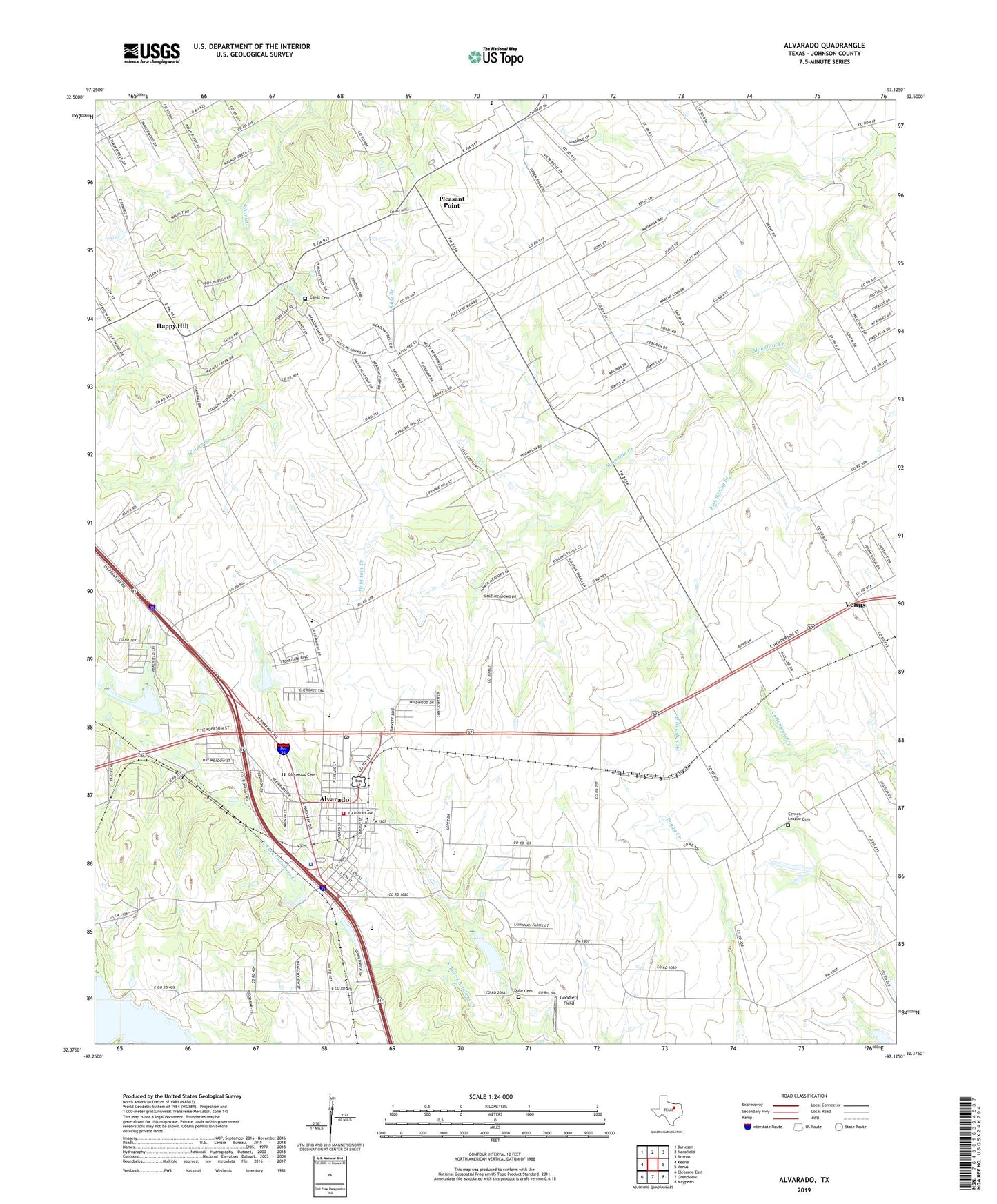
2022 topographic map quadrangle Alvarado in the state of Texas. Scale: 1:24000. Based on the newly updated USGS 7.5' US Topo map series, this map is in the following counties: Johnson. The map contains contour data, water features, and other items you are used to seeing on USGS maps, but also has updated roads and other features. This is the next generation of topographic maps. Printed on high-quality waterproof paper with UV fade-resistant inks.
Quads adjacent to this one:
West: Keene
Northwest: Burleson
North: Mansfield
Northeast: Britton
East: Venus
Southeast: Maypearl
South: Grandview
Southwest: Cleburne East
This map covers the same area as the classic USGS quad with code o32097d2.
Contains the following named places: Alvarado, Alvarado City Hall, Alvarado Division, Alvarado Elementary School - North, Alvarado Fire Department and Emergency Medical Services, Alvarado Intermediate School, Alvarado Junior High School, Alvarado Police Department, Alvarado Post Office, Balch Cemetery, Cahill Cemetery, Cahill Church, Center League Cemetery, Charles Head Stadium, Church of Christ, City of Alvarado, Duke Cemetery, First Missionary Baptist Church, Fish Spring Branch, Fundamental Baptist Church, George Washington Carver School, Glenwood Cemetery, Goodlett Field, Happy Hill, Hillside Baptist Church, Johnson County Constable's Office Precinct 3, Pleasant Point, Savinegrace Baptist Church, Soil Conservation Service Site 31 Dam, Soil Conservation Service Site 31 Reservoir, Soil Conservation Service Site 32 Dam, Soil Conservation Service Site 32 Reservoir, Soil Conservation Service Site 43a Dam, Soil Conservation Service Site 43a Reservoir, The Homesteads, The Homesteads Census Designated Place, Thompson Church, Willow Springs Church, ZIP Code: 76009