MyTopo
Calvary Texas US Topo Map
Couldn't load pickup availability
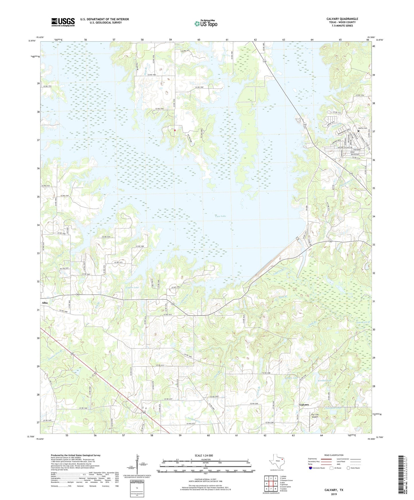
2019 topographic map quadrangle Calvary in the state of Texas. Scale: 1:24000. Based on the newly updated USGS 7.5' US Topo map series, this map is in the following counties: Wood. The map contains contour data, water features, and other items you are used to seeing on USGS maps, but also has updated roads and other features. This is the next generation of topographic maps. Printed on high-quality waterproof paper with UV fade-resistant inks.
Quads adjacent to this one:
West: Alba
Northwest: Arbala
North: Yantis
Northeast: Pleasant Grove
East: Quitman
Southeast: Mineola
South: Golden
Southwest: Grand Saline
Contains the following named places: Alba Division, Alba Oil Field, Alum Branch, Bell Branch, Brittain Lake Dam, Calvary, Calvary Church, Caney Creek, Case Lake, Champion Lake, Chaney Branch, Clark Branch, Dale Creek, Enon Church, Fly 1 On Airport, Hayes Lake, Hayes Lake Dam, Kendall Lake, Kindle Lake Dam, KMOO-FM (Mineola), Lake Fork Dam, Lake Fork Reservoir, Lands End Volunteer Fire Department, Little Caney Creek, Little Mustang Creek, Mustang Creek, Pilgrims Rest Number 2 Church, Pleasant Divide Church, Pleasant Ridge Church, Rainwater Creek, Ray Branch, Ring Branch Library, Robinson - Westchase Branch Library, Salem, Searcy Branch, Searcy Cemetery, Spring Branch Library, Taylor Branch, Taylor Lake, The Links at Land's End, Tomball Branch Library, Walter Branch Library, Williams Creek, Wolf Branch