MyTopo
Alba Texas US Topo Map
Couldn't load pickup availability
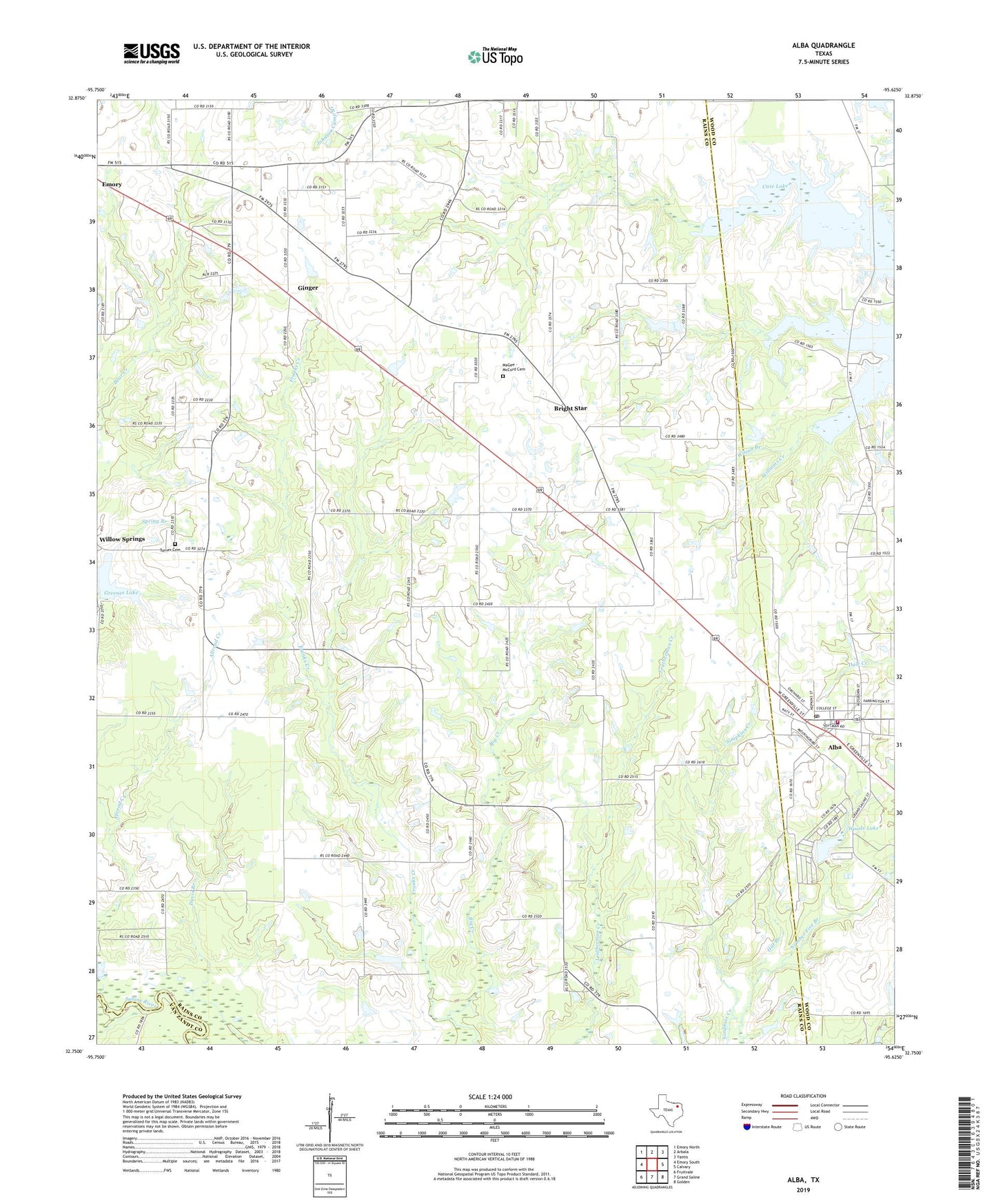
2022 topographic map quadrangle Alba in the state of Texas. Scale: 1:24000. Based on the newly updated USGS 7.5' US Topo map series, this map is in the following counties: Rains, Wood, Van Zandt. The map contains contour data, water features, and other items you are used to seeing on USGS maps, but also has updated roads and other features. This is the next generation of topographic maps. Printed on high-quality waterproof paper with UV fade-resistant inks.
Quads adjacent to this one:
West: Emory South
Northwest: Emory North
North: Arbala
Northeast: Yantis
East: Calvary
Southeast: Golden
South: Grand Saline
Southwest: Fruitvale
This map covers the same area as the classic USGS quad with code o32095g6.
Contains the following named places: Alba, Alba City Hall, Alba Police Department, Alba Post Office, Alba Volunteer Fire Department, Bellview, Big Creek, Bright Star, Colony, Colony Church, Emory Division, Ginger, Greenes Lake, Greenes Lake Dam, Gunter, Hill Branch, Jenkins Park, MaGee - McCord Cemetery, Pilgrim Rest Church, Salem Church, Town of Alba, Turner Cemetery, Wilson Branch, Woods Lake, Woods Lake Dam, ZIP Code: 75410