MyTopo
Canadian East Texas US Topo Map
Couldn't load pickup availability
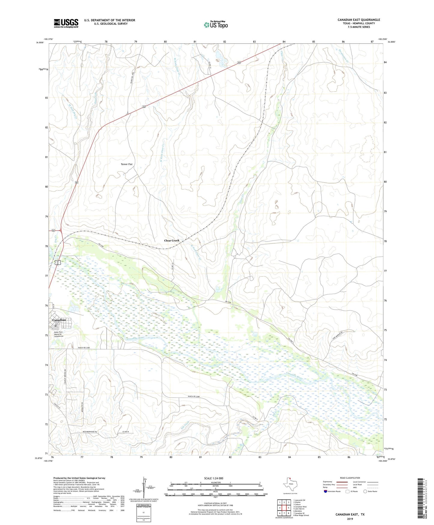
2019 topographic map quadrangle Canadian East in the state of Texas. Scale: 1:24000. Based on the newly updated USGS 7.5' US Topo map series, this map is in the following counties: Hemphill. The map contains contour data, water features, and other items you are used to seeing on USGS maps, but also has updated roads and other features. This is the next generation of topographic maps. Printed on high-quality waterproof paper with UV fade-resistant inks.
Quads adjacent to this one:
West: Canadian West
Northwest: Lipscomb SW
North: Glazier
Northeast: Coburn
East: Lake Marvin
Southeast: Blue Ridge School
South: Canadian SE
Southwest: Mendota
Contains the following named places: Anvil Park, Clear Creek, Dry Creek, Edith Ford Memorial Cemeteries, Elk Creek, Gene Howe Wildlife Management Area, McKay Creek, Tanner Flat, Urschel Ranch Airport, Urschell Ranch, West Fork Clear Creek, West Fork Dry Creek, ZIP Code: 79014