MyTopo
Canadian West Texas US Topo Map
Couldn't load pickup availability
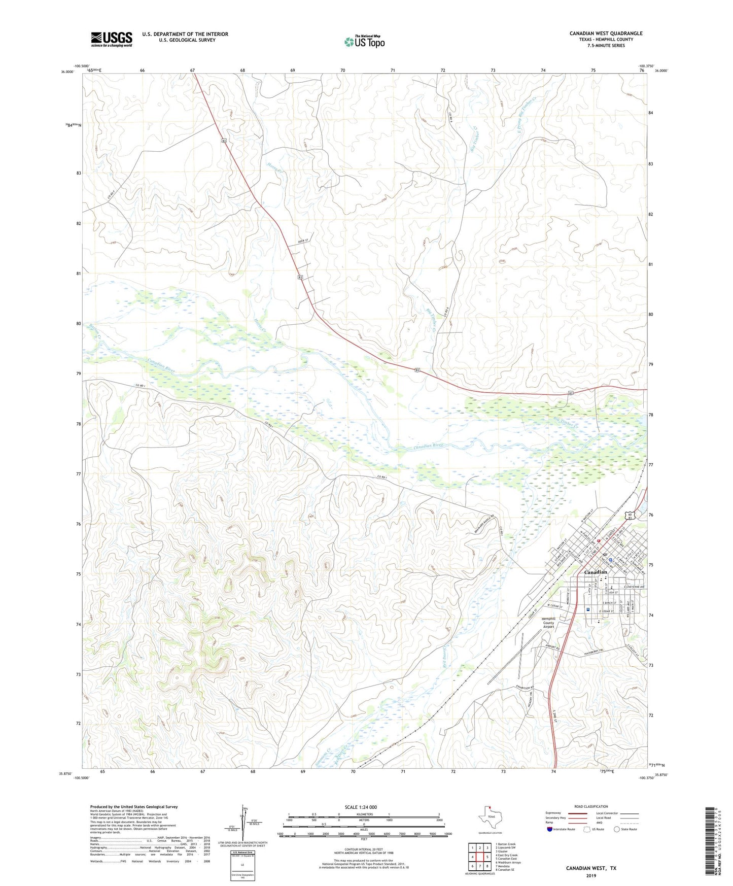
2022 topographic map quadrangle Canadian West in the state of Texas. Scale: 1:24000. Based on the newly updated USGS 7.5' US Topo map series, this map is in the following counties: Hemphill. The map contains contour data, water features, and other items you are used to seeing on USGS maps, but also has updated roads and other features. This is the next generation of topographic maps. Printed on high-quality waterproof paper with UV fade-resistant inks.
Quads adjacent to this one:
West: East Dry Creek
Northwest: Barton Creek
North: Lipscomb SW
Northeast: Glazier
East: Canadian East
Southeast: Canadian SE
South: Mendota
Southwest: Washburn Arroyo
This map covers the same area as the classic USGS quad with code o35100h4.
Contains the following named places: Abundant Life Assembly of God Church, Baker Elementary School, Baker School, Believers Covenant Fellowship Church, Big Timber Creek, Canadian, Canadian Alterative School, Canadian City Hall, Canadian Elementary School, Canadian High School, Canadian Middle School, Canadian North Division, Canadian Post Office, Canadian Volunteer Fire Department, Catholic Church, Central Baptist Church, City of Canadian, East Prong Big Timber Creek, First Baptist Church, First Presbyterian Church, Hemphill County Airport, Hemphill County Emergency Medical Services, Hemphill County Hospital, Hemphill County Jail, Hemphill County Sheriff's Office, Horse Creek, Methodist Church, Palace Theatre, Red Deer Creek, River Valley Pioneer Museum, West Horse Creek