
MyTopo
Cedar Bend Texas US Topo Map
Couldn't load pickup availability
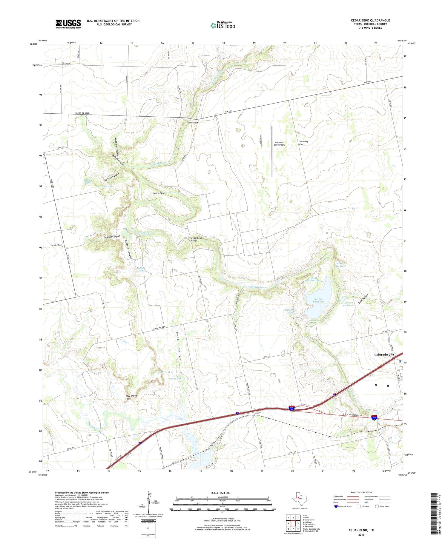
2019 topographic map quadrangle Cedar Bend in the state of Texas. Scale: 1:24000. Based on the newly updated USGS 7.5' US Topo map series, this map is in the following counties: Mitchell. The map contains contour data, water features, and other items you are used to seeing on USGS maps, but also has updated roads and other features. This is the next generation of topographic maps. Printed on high-quality waterproof paper with UV fade-resistant inks.
Quads adjacent to this one:
West: Cuthbert
Northwest: Ira
North: Dunn
Northeast: China Grove
East: Colorado City
Southeast: Colorado City SE
South: Lake Colorado City
Southwest: Westbrook
Contains the following named places: Badgett Canyon, Barber Lake, Barber Reservoir, Bone Hollow, Bullock Canyon, Bullock Tank, Buzzard Windmill, Cedar Bend, Cedar Bend Bridge, Clay Smith Peak, Colorado City Airport, Colorado River Off Channel Storage Dam, Col-Tex Refinery, Dawson Canyon, Fairview Church, Good Well Windmill, Handley Cemetery, Horns Chapel School, KAUM-FM (Colorado City), KVMC-AM (Colorado City), Little Blue Hole, Logsdon Reservoir, Low Bridge, Lower Tank, McGuire Canyon, McGuire Spring, McGuire Tank, Mitchell County Ambulance Service, Mitchell County Hospital, Moser Canyon, North Fork Canyon, Oil Well Windmill, Rabbit Hollow, Rogers School, Shinnery Flats, Strain Pool Oil Field, Texas Department of Criminal Justice Daniel Webster Wallace Unit, Texas Department of Criminal Justice Dick Ware Transfer Facility, Twin Windmill, Upper Tank, Wheat Pasture Tank


