
MyTopo
Cedar Mountain Texas US Topo Map
Couldn't load pickup availability
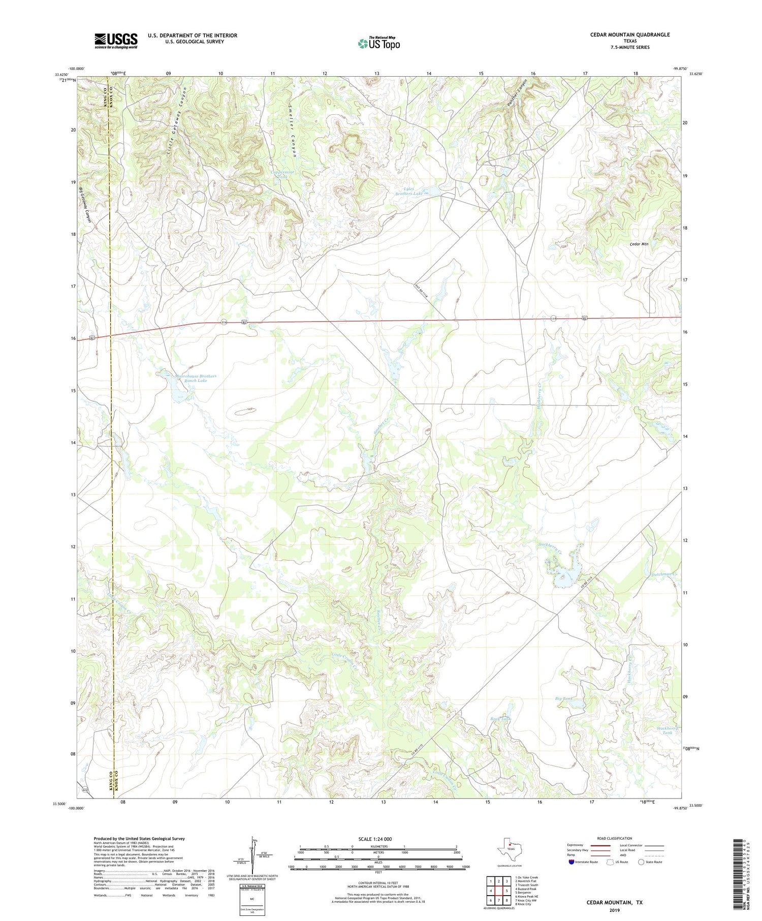
2019 topographic map quadrangle Cedar Mountain in the state of Texas. Scale: 1:24000. Based on the newly updated USGS 7.5' US Topo map series, this map is in the following counties: Knox, King. The map contains contour data, water features, and other items you are used to seeing on USGS maps, but also has updated roads and other features. This is the next generation of topographic maps. Printed on high-quality waterproof paper with UV fade-resistant inks.
Quads adjacent to this one:
West: Buzzard Peak
Northwest: Ox Yoke Creek
North: Maverick Flat
Northeast: Truscott South
East: Benjamin
Southeast: Knox City
South: Knox City NW
Southwest: Kiowa Peak NE
Contains the following named places: Big Tank, Cedar Mountain, Coppermine Tank, Croton Windmill, Driver Ranch, Hackberry Tank, Horseshoe Tank, Horseshoe Tank Dam, Little Dick Windmill, Lyles Brothers Lake, Lyles Brothers Lake Dam, Lyles Ranch, McFaddin Ranch, Moorehouse Brothers Ranch Lake, Moorehouse Brothers Ranch Lake Dam, Rock Tank, Smelter Creek, Williams Ranch


