MyTopo
Knox City NW Texas US Topo Map
Couldn't load pickup availability
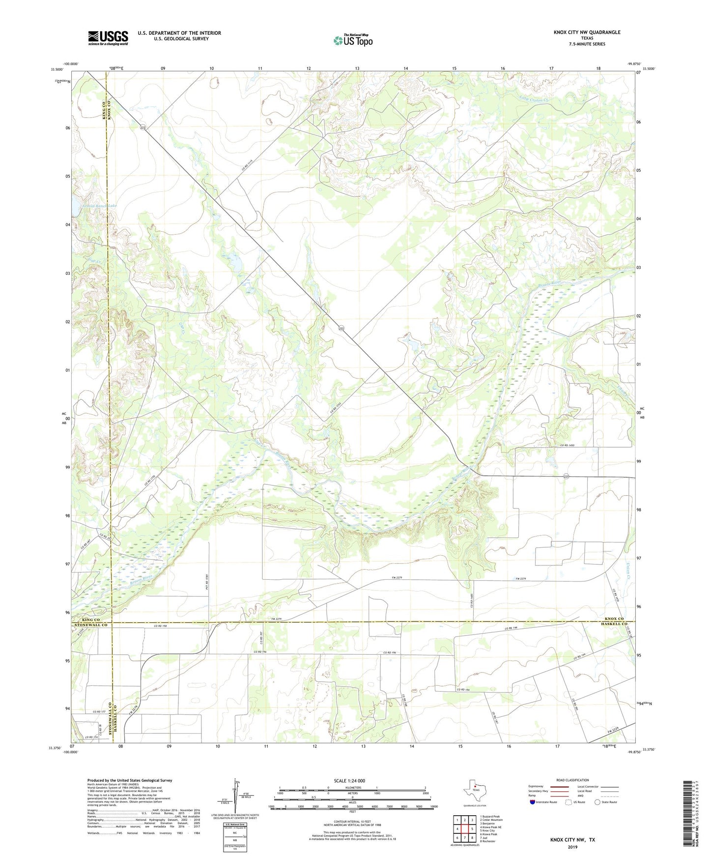
2022 topographic map quadrangle Knox City NW in the state of Texas. Scale: 1:24000. Based on the newly updated USGS 7.5' US Topo map series, this map is in the following counties: Knox, Haskell, King, Stonewall. The map contains contour data, water features, and other items you are used to seeing on USGS maps, but also has updated roads and other features. This is the next generation of topographic maps. Printed on high-quality waterproof paper with UV fade-resistant inks.
Quads adjacent to this one:
West: Kiowa Peak NE
Northwest: Buzzard Peak
North: Cedar Mountain
Northeast: Benjamin
East: Knox City
Southeast: Rochester
South: Jud
Southwest: Kiowa Peak
This map covers the same area as the classic USGS quad with code o33099d8.
Contains the following named places: Arnold Ranch Lake, Arnold Ranch Lake Dam, Gyp Creek, Hackberry Creek, Union Creek