MyTopo
Center Texas US Topo Map
Couldn't load pickup availability
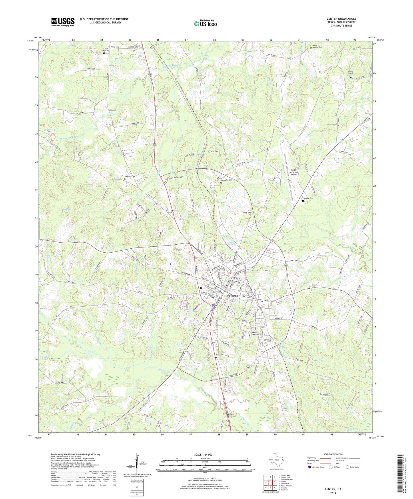
2019 topographic map quadrangle Center in the state of Texas. Scale: 1:24000. Based on the newly updated USGS 7.5' US Topo map series, this map is in the following counties: Shelby. The map contains contour data, water features, and other items you are used to seeing on USGS maps, but also has updated roads and other features. This is the next generation of topographic maps. Printed on high-quality waterproof paper with UV fade-resistant inks.
Quads adjacent to this one:
West: Arcadia
Northwest: Tenaha West
North: Tenaha East
Northeast: Logansport West
East: Shelbyville
Southeast: Hurstown
South: Neuville
Southwest: Mount Herman
Contains the following named places: Asbury Chapel Cemetery, Blunt Cemetery, Blunt Chapel, Bush Creek, C H Daniels Intermediate School, Cedar Yard Cemetery, Center, Center City Hall, Center Country Club, Center Division, Center Elementary School, Center Fire Department, Center High School, Center Independent School District Police Department, Center Junior High School, Center Municipal Airport, Center Police Department, Center Post Office, City of Center, Fairview Cemetery, Henrietta Cemetery, Irish Creek, Jericho School, Jones Branch, KDET-AM (Center), KLCR-FM (Center), Lamar, Mull Cemetery, Newburn Cemetery, Newhope Church, North East Texas Emergency Medical Service, North Jericho, North Jericho Baptist Church, North Jericho Cemetery, Oaklawn Cemetery, Oliver Creek, Pleasant Grove Cemetery, Prairie View Cemetery, Saint John Church, Shelby County, Shelby County Courthouse Square, Shelby County Jail, Shelby County Museum, Shelby County Sheriff's Department, Shelby Regional Medical Center, Shofner Creek, Smith Cemetery, Smith Creek, Webb