MyTopo
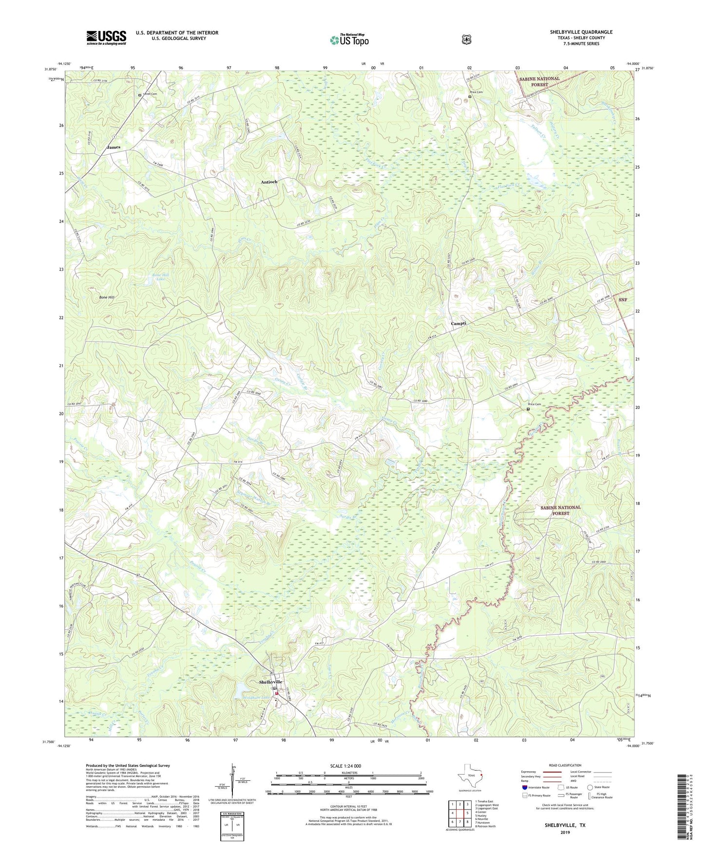
Shelbyville Texas US Topo Map
Couldn't load pickup availability
Also explore the Shelbyville Forest Service Topo of this same quad for updated USFS data
2022 topographic map quadrangle Shelbyville in the state of Texas. Scale: 1:24000. Based on the newly updated USGS 7.5' US Topo map series, this map is in the following counties: Shelby. The map contains contour data, water features, and other items you are used to seeing on USGS maps, but also has updated roads and other features. This is the next generation of topographic maps. Printed on high-quality waterproof paper with UV fade-resistant inks.
Quads adjacent to this one:
West: Center
Northwest: Tenaha East
North: Logansport West
Northeast: Logansport East
East: Huxley
Southeast: Patroon North
South: Hurstown
Southwest: Neuville
This map covers the same area as the classic USGS quad with code o31094g1.
Contains the following named places: Antioch, Antioch Church, Beauchamp Creek, Bell Creek, Bivens Branch, Blankenship Creek, Bone Hill, Bone Hill Lake, Bone Hill Lake Dam, Campti, Caney Creek, Carls Chapel, Carlyle Branch, Clark Creek, Cooney Creek, Cuba Church, Dry Creek, Good Hope Church, Hawkeye Hunt Club, Huana Creek, James, Mill Creek, Morrison Creek, Plum Creek, Porter Creek, Prairie Creek, Price Campti Cemetery, Price Cemetery, Sardis, Sardis Branch, Sardis Cemetery, Seymour Watson Branch, Shelbyville, Shelbyville Census Designated Place, Shelbyville Post Office, Shelbyville Volunteer Fire Department, Smith Cemetery, Talbert Creek, Town Creek, Watery Creek, Willsie Branch, Windham Lake, Windham Lake Dam, Wolf Creek