MyTopo
Charleston Texas US Topo Map
Couldn't load pickup availability
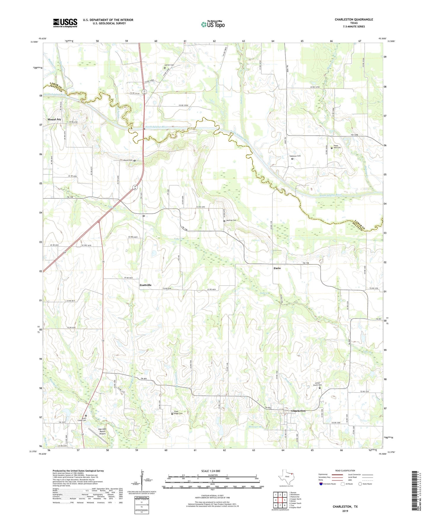
2019 topographic map quadrangle Charleston in the state of Texas. Scale: 1:24000. Based on the newly updated USGS 7.5' US Topo map series, this map is in the following counties: Delta, Lamar. The map contains contour data, water features, and other items you are used to seeing on USGS maps, but also has updated roads and other features. This is the next generation of topographic maps. Printed on high-quality waterproof paper with UV fade-resistant inks.
Quads adjacent to this one:
West: Cooper North
Northwest: Roxton
North: Biardstown
Northeast: Pattonville
East: Minter
Southeast: Sulphur Bluff
South: Tira
Southwest: Cooper South
Contains the following named places: Auds Creek, Brush Creek Cemetery, Charleston, Cherry Creek, Clark Ridge Cemetery, Cooper Division, Delta Country Club Dam, Delta Country Club Lake, East Delta, Gadston, Garner Cemetery, Hazel Dell Cemetery, Hickory Creek, Justiss Creek, Kennemer Crossing, Lake Creek, Lake Creek Post Office, Mallory Creek, Mount Joy, Mount Joy Crossing, Oak Glen Ranch Airport, Pacio, Pierce Cemetery, Post Oak, Prattville, Robertson Creek, Slabtown, Slabtown Cemetery, Union Grove Cemetery, Winfrey Cemetery