MyTopo
Tira Texas US Topo Map
Couldn't load pickup availability
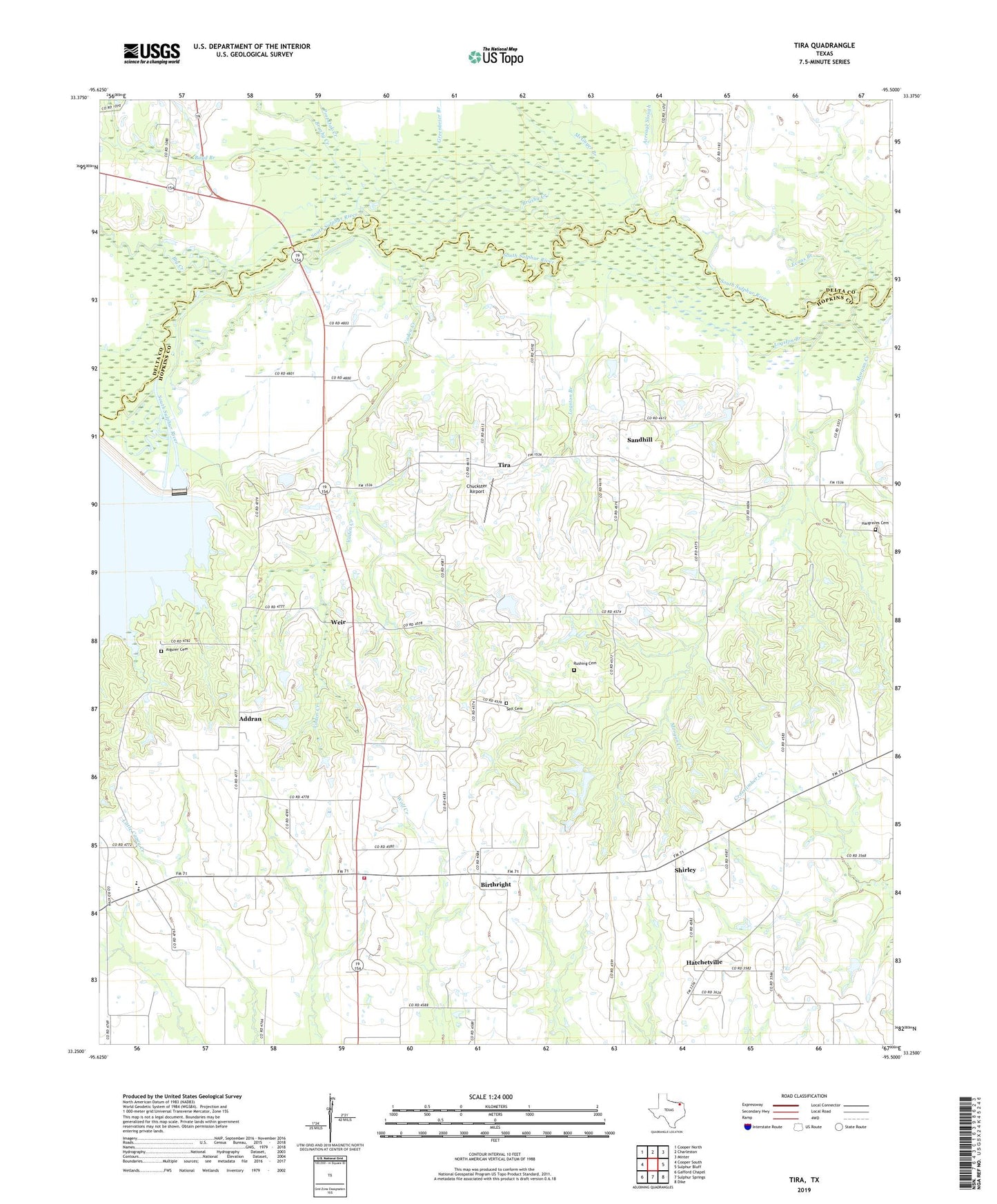
2022 topographic map quadrangle Tira in the state of Texas. Scale: 1:24000. Based on the newly updated USGS 7.5' US Topo map series, this map is in the following counties: Hopkins, Delta. The map contains contour data, water features, and other items you are used to seeing on USGS maps, but also has updated roads and other features. This is the next generation of topographic maps. Printed on high-quality waterproof paper with UV fade-resistant inks.
Quads adjacent to this one:
West: Cooper South
Northwest: Cooper North
North: Charleston
Northeast: Minter
East: Sulphur Bluff
Southeast: Dike
South: Sulphur Springs
Southwest: Gafford Chapel
This map covers the same area as the classic USGS quad with code o33095c5.
Contains the following named places: Acreage Slough, Addran, Aiguier Cemetery, Big Creek, Birthright, Boyd Branch, Brushy Creek, Chuckster Airport, Evans Branch, Greenbrier Branch, Hargraves Cemetery, Hatchetville, Little Self Cemetery, Logston Branch, McGuyer Branch, New Birthright, North Hopkins, North Hopkins School, North Hopkins Volunteer Fire Department - First Responders, Oak Grove, Oakdale, Post Oak Creek, Rushing Cemetery, Sandhill, Shirley, Tira, Town of Tira, Vaden Creek, Weir