MyTopo
Childress Texas US Topo Map
Couldn't load pickup availability
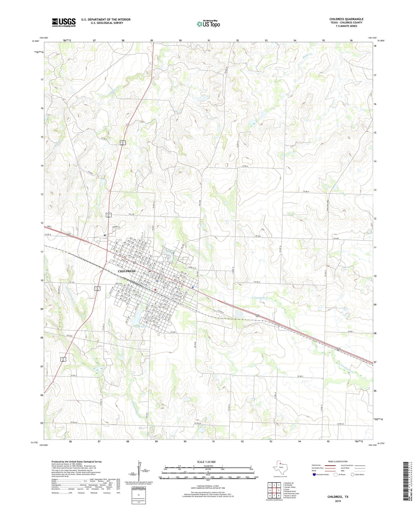
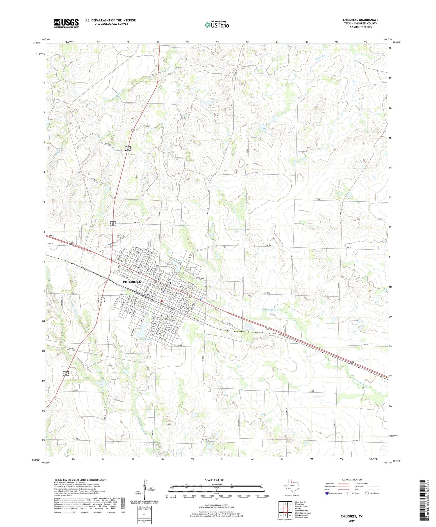
2019 topographic map quadrangle Childress in the state of Texas. Scale: 1:24000. Based on the newly updated USGS 7.5' US Topo map series, this map is in the following counties: Childress. The map contains contour data, water features, and other items you are used to seeing on USGS maps, but also has updated roads and other features. This is the next generation of topographic maps. Printed on high-quality waterproof paper with UV fade-resistant inks.
Quads adjacent to this one:
West: Carey
Northwest: Estelline SE
North: Smithdale
Northeast: Garden Valley
East: Kirkland North
Southeast: Kirkland South
South: Buckle L Ranch
Southwest: Hell Roaring Creek
Contains the following named places: Bible Baptist Church, Childress, Childress Cemetery, Childress City Hall, Childress Country Club, Childress County Constable's Office, Childress County Detention Center, Childress County Heritage Museum, Childress County Sheriff's Office, Childress Division, Childress Elementary School, Childress Fire Department, Childress High School, Childress Junior High School, Childress Police Department, Childress Post Office, Childress Regional Medical Center, Church of Christ Childress, East Ward School, Fair Park, Fair Park Stadium, Fairview United Pentecostal Church, Holy Angels Catholic Church, KCTX-AM (Childress), KSRW-FM (Childress), Lake Scott, Lake Scott Dam, New Hope Baptist Church, Park Lake, Park Lake Dam, Parkview Baptist Church, Robert E Lee School, Saint John Baptist Church, Texas Highway Patrol Office - Childress, Txnoname 1 Dam, Wilson School