MyTopo
Carey Texas US Topo Map
Couldn't load pickup availability
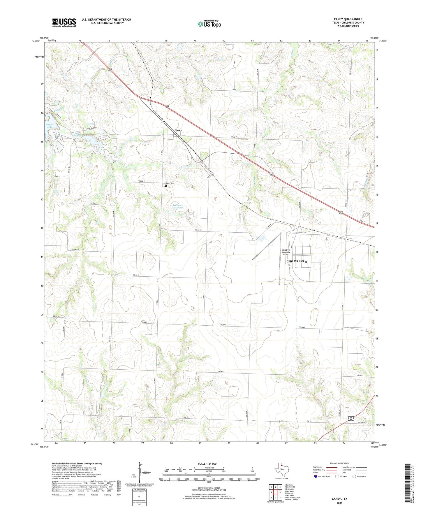
2022 topographic map quadrangle Carey in the state of Texas. Scale: 1:24000. Based on the newly updated USGS 7.5' US Topo map series, this map is in the following counties: Childress. The map contains contour data, water features, and other items you are used to seeing on USGS maps, but also has updated roads and other features. This is the next generation of topographic maps. Printed on high-quality waterproof paper with UV fade-resistant inks.
Quads adjacent to this one:
West: Tell North
Northwest: Estelline
North: Estelline SE
Northeast: Smithdale
East: Childress
Southeast: Buckle L Ranch
South: Hell Roaring Creek
Southwest: Tell South
This map covers the same area as the classic USGS quad with code o34100d3.
Contains the following named places: Baylor Lake, Baylor Lake Dam, Carey, Carey Cemetery, Childress Army Air Field, Childress Municipal Airport, City of Childress, High Point, Lake Childress, Lake Childress Dam, Texas Department of Criminal Justice T L Roach Unit, Texas No Name Number 23 Dam, Williams Dam, Williams Reservoir, ZIP Code: 79201