MyTopo
China Texas US Topo Map
Couldn't load pickup availability
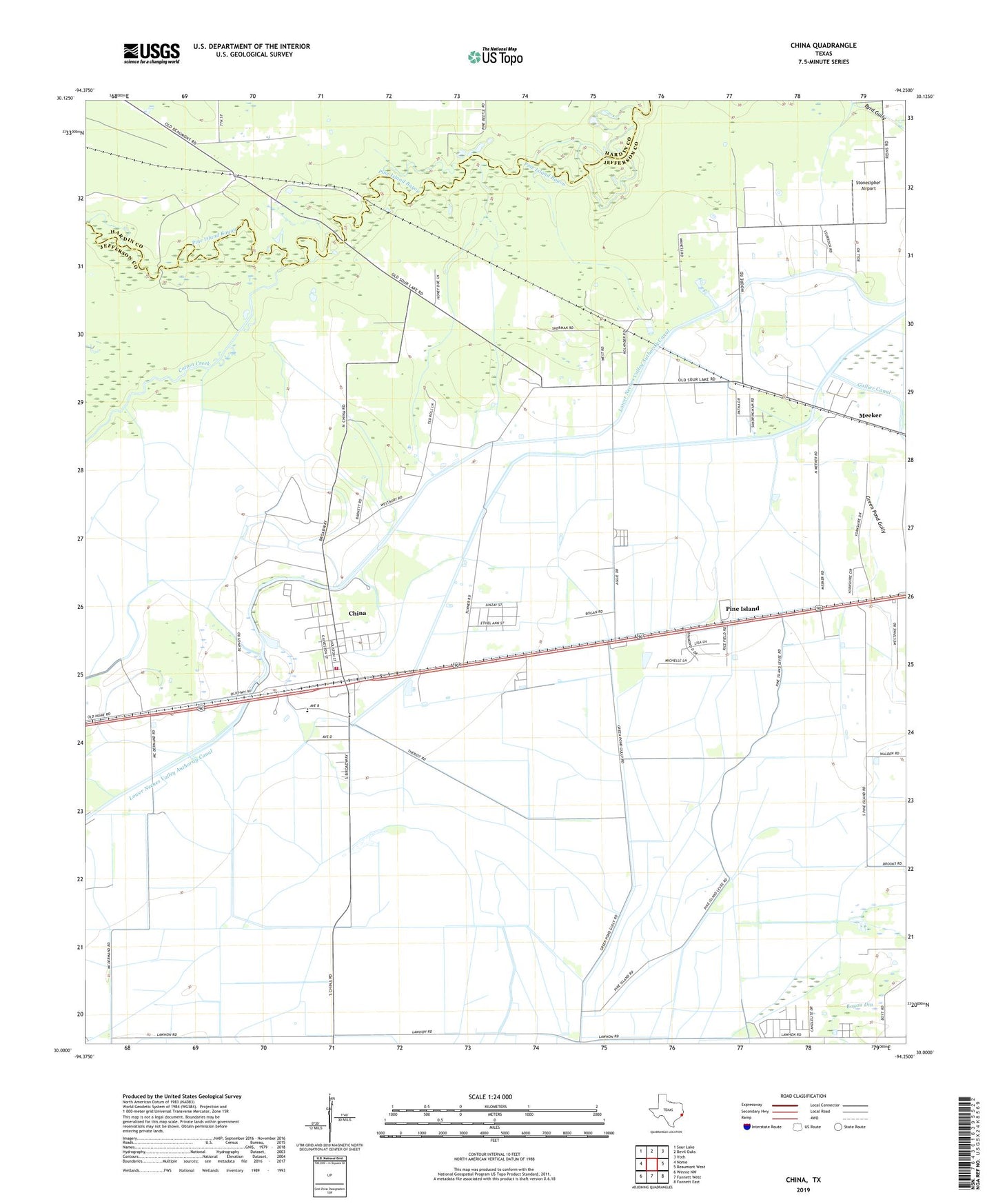
2019 topographic map quadrangle China in the state of Texas. Scale: 1:24000. Based on the newly updated USGS 7.5' US Topo map series, this map is in the following counties: Jefferson, Hardin. The map contains contour data, water features, and other items you are used to seeing on USGS maps, but also has updated roads and other features. This is the next generation of topographic maps. Printed on high-quality waterproof paper with UV fade-resistant inks.
Quads adjacent to this one:
West: Nome
Northwest: Sour Lake
North: Bevil Oaks
Northeast: Voth
East: Beaumont West
Southeast: Fannett East
South: Fannett West
Southwest: Winnie NW
Contains the following named places: China, China City Hall, China Post Office, China Volunteer Fire Department, City of China, Cotton Creek, Henderson School, Lower Neches Valley Authority Canal, Meeker, Nome-China Division, Pine Island, Stonecipher Airport, Texas Agricultural Experiment Station, West Jefferson County Volunteer Emergency Medical Service, Westbury, ZIP Codes: 77613, 77713