MyTopo
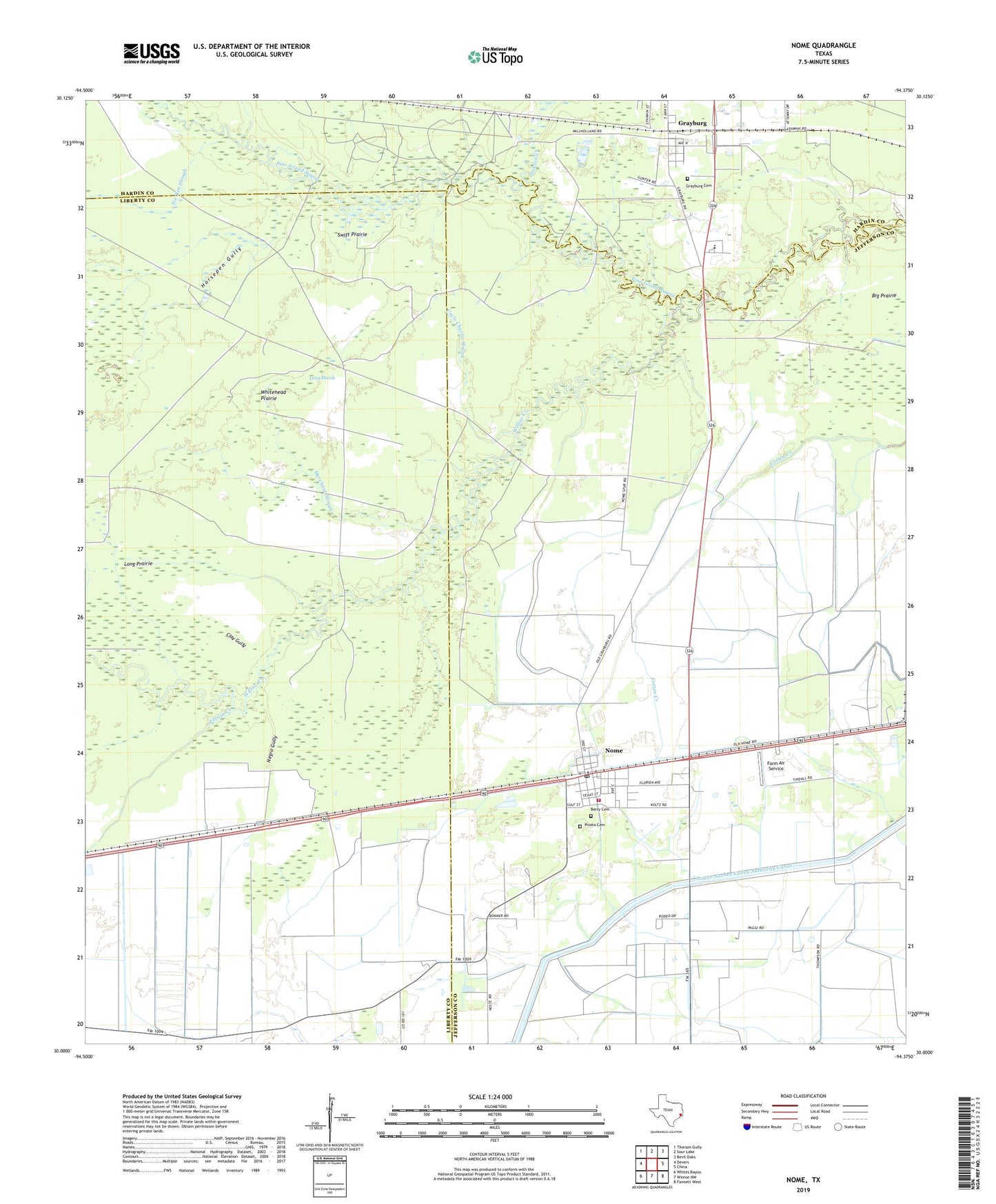
Nome Texas US Topo Map
Couldn't load pickup availability
2022 topographic map quadrangle Nome in the state of Texas. Scale: 1:24000. Based on the newly updated USGS 7.5' US Topo map series, this map is in the following counties: Jefferson, Liberty, Hardin. The map contains contour data, water features, and other items you are used to seeing on USGS maps, but also has updated roads and other features. This is the next generation of topographic maps. Printed on high-quality waterproof paper with UV fade-resistant inks.
Quads adjacent to this one:
West: Devers
Northwest: Thorson Gully
North: Sour Lake
Northeast: Bevil Oaks
East: China
Southeast: Fannett West
South: Winnie NW
Southwest: Whites Bayou
This map covers the same area as the classic USGS quad with code o30094a4.
Contains the following named places: Berry Cemetery, Big Prairie, Bogan & Fontenot Airport, City of Nome, Clay Gully, Cypress Pond, Farm Air Service, Felicia Creek, Grayburg, Grayburg Cemetery, Horsepen Gully, Jackson Creek, Long Marsh, Long Prairie, Lost Dog Cabin, Merchant Slough, Nome, Nome City Hall, Nome Fire Department, Nome Oil Field, Nome Post Office, Norris Cuney Gully, North Willis Airport, Pivoto Cemetery, Six-Ten Slough, Swift Prairie, Uncle Charlie Slough, Whiskey Ford, Whitehead Prairie, Willow Creek