MyTopo
Chinquapin Texas US Topo Map
Couldn't load pickup availability
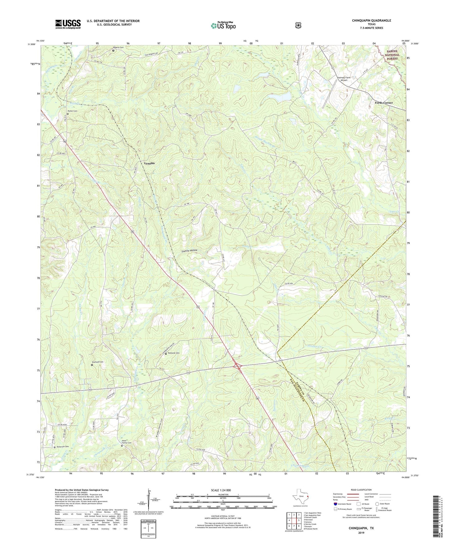
2019 topographic map quadrangle Chinquapin in the state of Texas. Scale: 1:24000. Based on the newly updated USGS 7.5' US Topo map series, this map is in the following counties: San Augustine, Sabine. The map contains contour data, water features, and other items you are used to seeing on USGS maps, but also has updated roads and other features. This is the next generation of topographic maps. Printed on high-quality waterproof paper with UV fade-resistant inks.
Quads adjacent to this one:
West: Norwood
Northwest: San Augustine West
North: San Augustine East
Northeast: Patroon South
East: Geneva
Southeast: Pineland North
South: Bronson
Southwest: Harvey Creek
Contains the following named places: Bethel Church, Carrizo Creek, Chinquapin, Clear Branch, Clear Creek, Conville, Dickerson Cemetery, Fairway Farm Airport, Fairway Hunt Club, Fords Corner, Grapevine Church, Head Cemetery, Magnolia Church, Maxey Town, Mount Horeb Church, Parker Cemetery, Pine Grove Church, Price Branch, Rebecca, Redlands Cemetery, Roberts Cemetery, Roberts Church, Rocky Creek, Sheffield Cemetery, Shingle Machine Branch, Sixmile Hollow, Steep Creek, Venable