MyTopo
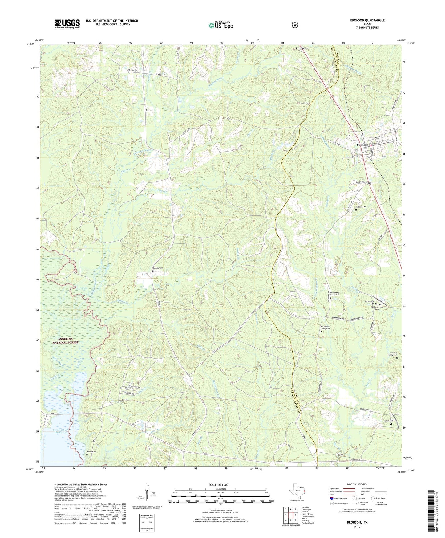
Bronson Texas US Topo Map
Couldn't load pickup availability
Also explore the Bronson Forest Service Topo of this same quad for updated USFS data
2022 topographic map quadrangle Bronson in the state of Texas. Scale: 1:24000. Based on the newly updated USGS 7.5' US Topo map series, this map is in the following counties: San Augustine, Sabine. The map contains contour data, water features, and other items you are used to seeing on USGS maps, but also has updated roads and other features. This is the next generation of topographic maps. Printed on high-quality waterproof paper with UV fade-resistant inks.
Quads adjacent to this one:
West: Harvey Creek
Northwest: Norwood
North: Chinquapin
Northeast: Geneva
East: Pineland North
Southeast: Pineland South
South: Buck Bay
Southwest: Veach
This map covers the same area as the classic USGS quad with code o31094c1.
Contains the following named places: Anthony Harbor, Beauchamp Family Cemetery, Blue Springs, Bobbitt Cemetery, Bobbitt Creek, Bronson, Bronson Cemetery, Bronson Post Office, Bronson Rural Volunteer Fire Department, Caney Creek, Centerview Cemetery, Chiamon Bayou, Copelle Creek, Dickey Creek, Farrise Creek, Glen Oaks, Goose Branch, Horton Cemetery, Jack Williams Creek, Little Creek, Little Flock Missionary Church, Martin Cemetery, McBride Cemetery, McClelland Family Cemetery, Old Centerview Cemetery, Sabine County Constable's Office Precinct 2, Sandy Creek, Steep Mile Creek, Tiger Creek, Tilde Creek, Whitton Family Cemetery, Woods Cemetery, ZIP Code: 75930