MyTopo
Chireno North Texas US Topo Map
Couldn't load pickup availability
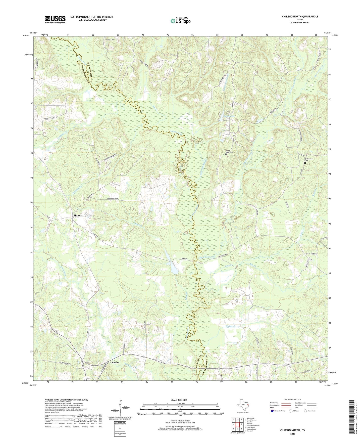
2019 topographic map quadrangle Chireno North in the state of Texas. Scale: 1:24000. Based on the newly updated USGS 7.5' US Topo map series, this map is in the following counties: San Augustine, Nacogdoches. The map contains contour data, water features, and other items you are used to seeing on USGS maps, but also has updated roads and other features. This is the next generation of topographic maps. Printed on high-quality waterproof paper with UV fade-resistant inks.
Quads adjacent to this one:
West: Melrose
Northwest: Martinsville
North: Mount Herman
Northeast: Neuville
East: San Augustine West
Southeast: Norwood
South: Chireno South
Southwest: Etoile North
Contains the following named places: Apostolic Church, Attoyac, Big Iron Ore Creek, Black Branch, Blue Creek, Bog Creek, Camp Worth, Gethsemane Cemetery, Horsepen Branch, Hulse Creek, Little Iron Ore Creek, New Hope, Niciper Creek, Pat Scoggins Dam, Price Creek, Ratcliff Church, Rocky Mound Church, Scoggins Lake, Spring Lake, Spring Lake Dam, Spring Ridge Cemetery, Tandakee Creek, Tupelo Gum Slough