MyTopo
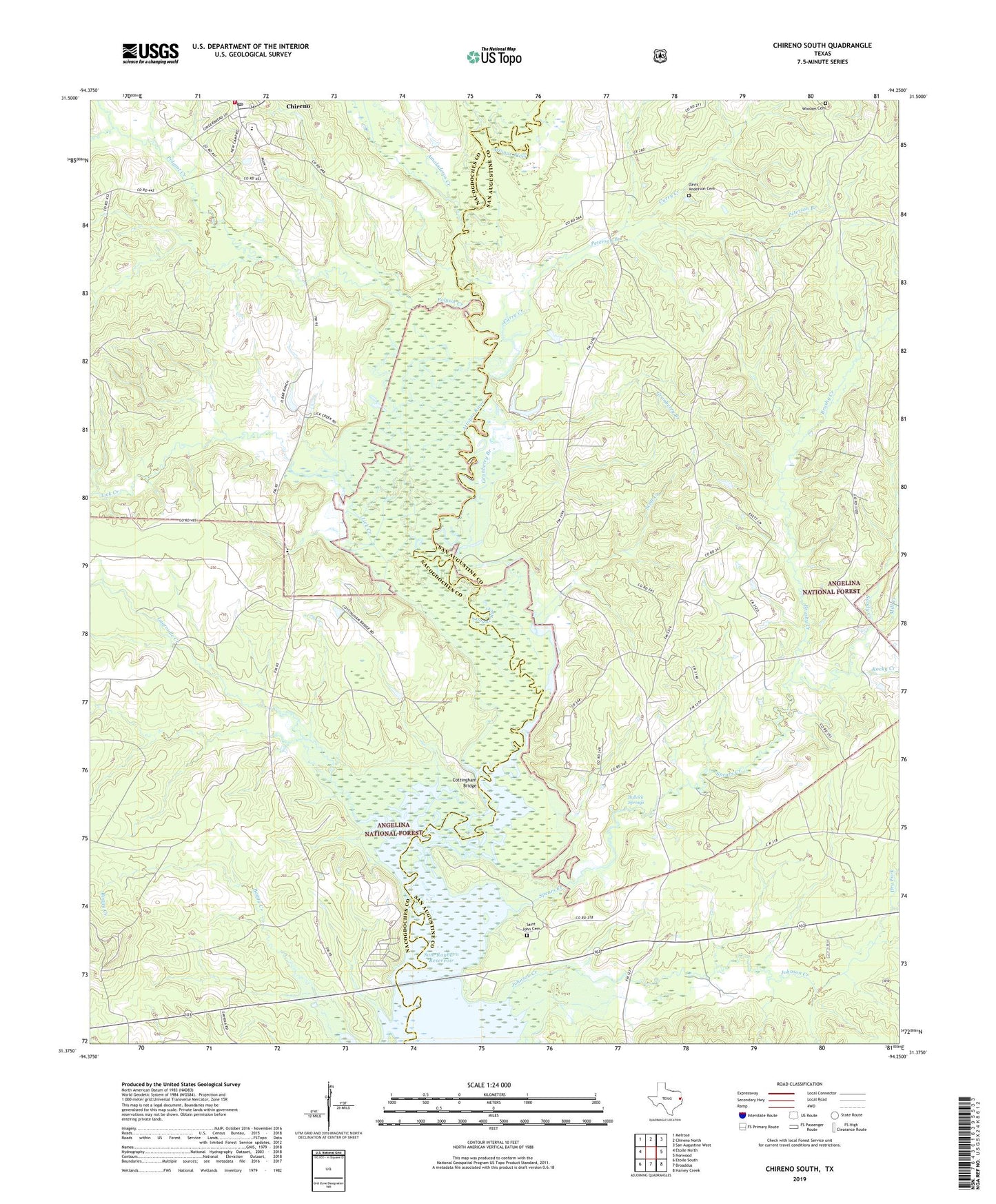
Chireno South Texas US Topo Map
Couldn't load pickup availability
Also explore the Chireno South Forest Service Topo of this same quad for updated USFS data
2022 topographic map quadrangle Chireno South in the state of Texas. Scale: 1:24000. Based on the newly updated USGS 7.5' US Topo map series, this map is in the following counties: San Augustine, Nacogdoches. The map contains contour data, water features, and other items you are used to seeing on USGS maps, but also has updated roads and other features. This is the next generation of topographic maps. Printed on high-quality waterproof paper with UV fade-resistant inks.
Quads adjacent to this one:
West: Etoile North
Northwest: Melrose
North: Chireno North
Northeast: San Augustine West
East: Norwood
Southeast: Harvey Creek
South: Broaddus
Southwest: Etoile South
This map covers the same area as the classic USGS quad with code o31094d3.
Contains the following named places: Amaladeros Creek, Antioch Church, Attoyac Church, Attoyac River, B E Gartman Estate Dam, B E Gartman Lake, Brushy Creek, Bullock Springs, Chireno, Chireno City Office, Chireno Post Office, Chireno Volunteer Fire Department, City of Chireno, Cottingham Bridge, Curry Creek, Davis - Anderson Cemetery, Dry Fork, Goodwin, Granberry Branch, Johnson Creek, Lagroulle Creek, Lick Creek, Lower Chireno Cemetery, Mill Creek, Peterson Branch, Polysot Creek, Ralf T McAlister, Rocky Creek, Rocky Mount Church, Running Branch, Saint John Cemetery, Saint John Church, Sandy Creek, Scott Creek, Spears Creek, Woolam Cemetery, ZIP Code: 75937