MyTopo
Crystal Falls Texas US Topo Map
Couldn't load pickup availability
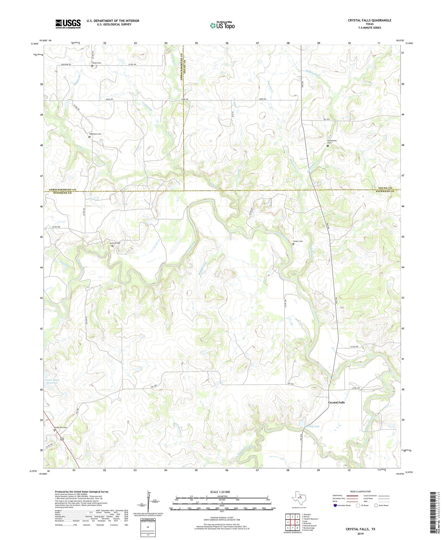
2019 topographic map quadrangle Crystal Falls in the state of Texas. Scale: 1:24000. Based on the newly updated USGS 7.5' US Topo map series, this map is in the following counties: Stephens, Young, Throckmorton. The map contains contour data, water features, and other items you are used to seeing on USGS maps, but also has updated roads and other features. This is the next generation of topographic maps. Printed on high-quality waterproof paper with UV fade-resistant inks.
Quads adjacent to this one:
West: Lusk
Northwest: Woodson
North: Murray
Northeast: Tackett Mountain
East: Eliasville
Southeast: Grand Lake
South: Breckenridge
Southwest: Edwards Branch
Contains the following named places: Bloomfield Branch, Buffalo Branch, Coal Branch, Crooked Branch, Crystal Falls, Crystal Falls Dam, Crystal Falls Reservoir, Dooley Lake, Dooley Lake Dam, East Kings Creek, Givens Creek, Gunsolus Creek, Hubbard Creek, Huffstuttle Cemetery, Huffstuttle Creek, Hurford Cemetery, Kings Creek, Lester Clark Reservoir, Mathiews Cemetery, Peacock Creek, Powers Dam, Powers Reservoir, Six Shooter Creek, Smith Cemetery, Snake Den Cemetery, Stoker Cemetery