MyTopo
Darrouzett Texas US Topo Map
Couldn't load pickup availability
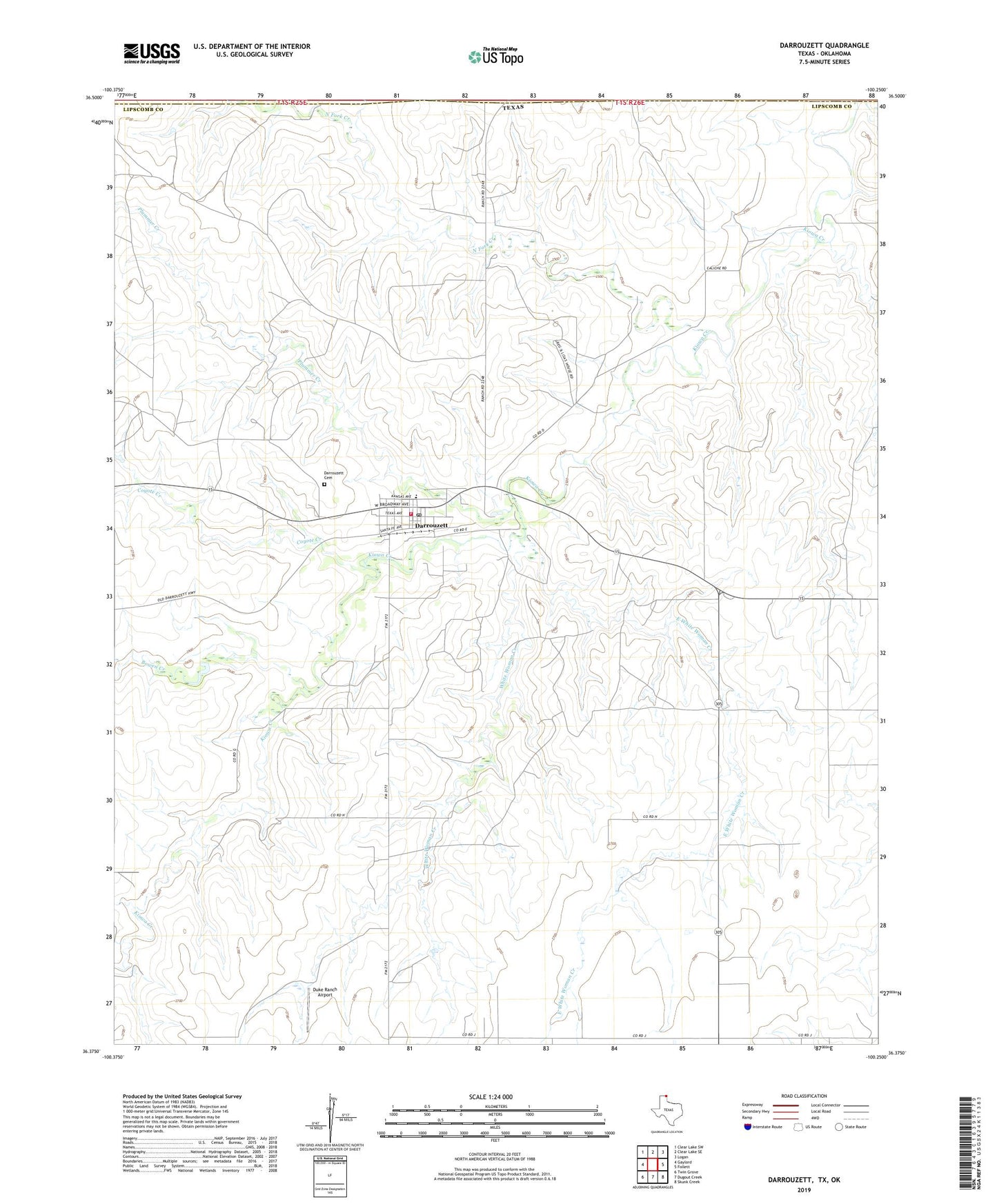
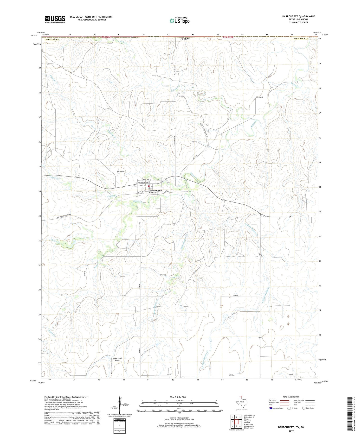
2019 topographic map quadrangle Darrouzett in the state of Texas. Scale: 1:24000. Based on the newly updated USGS 7.5' US Topo map series, this map is in the following counties: Lipscomb, Beaver. The map contains contour data, water features, and other items you are used to seeing on USGS maps, but also has updated roads and other features. This is the next generation of topographic maps. Printed on high-quality waterproof paper with UV fade-resistant inks.
Quads adjacent to this one:
West: Gaylord
Northwest: Clear Lake SW
North: Clear Lake SE
Northeast: Logan
East: Follett
Southeast: Skunk Creek
South: Dugout Creek
Southwest: Twin Grove
Contains the following named places: Bowen Creek, Coyote Creek, Darrouzett, Darrouzett Cemetery, Darrouzett City Hall, Darrouzett Emergency Medical Service, Darrouzett Post Office, Darrouzett Volunteer Fire Department, Duke Ranch Airport, East White Woman Creek, North Fork Creek, North Fork Kiowa Creek, Plummer Creek, Town of Darrouzett, White Woman Creek, ZIP Code: 79024