MyTopo
Dellahunt Draw East Texas US Topo Map
Couldn't load pickup availability
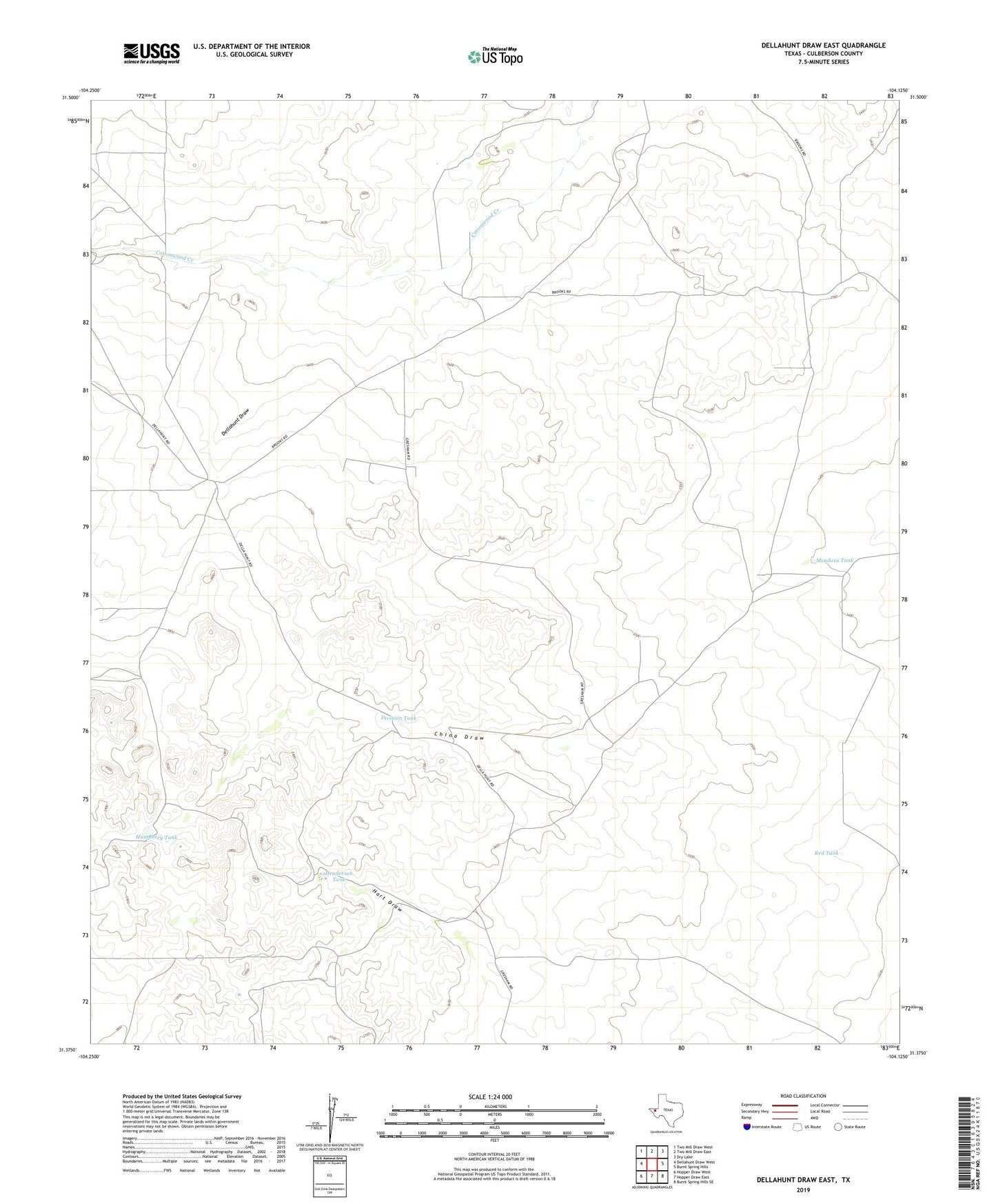
2019 topographic map quadrangle Dellahunt Draw East in the state of Texas. Scale: 1:24000. Based on the newly updated USGS 7.5' US Topo map series, this map is in the following counties: Culberson. The map contains contour data, water features, and other items you are used to seeing on USGS maps, but also has updated roads and other features. This is the next generation of topographic maps. Printed on high-quality waterproof paper with UV fade-resistant inks.
Quads adjacent to this one:
West: Dellahunt Draw West
Northwest: Two Mill Draw West
North: Two Mill Draw East
Northeast: Dry Lake
East: Burnt Spring Hills
Southeast: Burnt Spring Hills SE
South: Hopper Draw East
Southwest: Hopper Draw West
Contains the following named places: Dellahunt Draw, Division Tank, Division Windmill, Grisham Pumping Station, Gulf Windmill, Henderson Tank, Humphrey Tank, Little Sulphur Windmill, McCutchum Windmill, Mendoza Tank, Orchard Windmill, Red Tank, Road Windmill, Sheep Camp Windmill