MyTopo
Burnt Spring Hills SE Texas US Topo Map
Couldn't load pickup availability
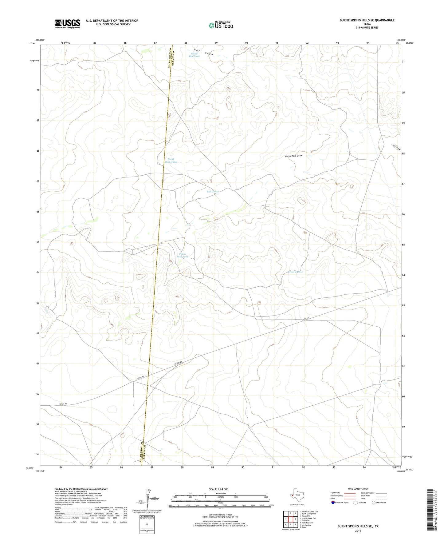
2022 topographic map quadrangle Burnt Spring Hills SE in the state of Texas. Scale: 1:24000. Based on the newly updated USGS 7.5' US Topo map series, this map is in the following counties: Reeves, Culberson. The map contains contour data, water features, and other items you are used to seeing on USGS maps, but also has updated roads and other features. This is the next generation of topographic maps. Printed on high-quality waterproof paper with UV fade-resistant inks.
Quads adjacent to this one:
West: Hopper Draw East
Northwest: Dellahunt Draw East
North: Burnt Spring Hills
Northeast: Toyah NW
East: Toyah SW
Southeast: Gozar
South: San Martine
Southwest: Iron Mountain
This map covers the same area as the classic USGS quad with code o31104c1.
Contains the following named places: Bull Tank, County Line Windmill, Double Well, Fence Line Windmill, Frijol Tank, Garden Windmill, Goose Windmill, Hart Draw, Hart Ranch, Herds Pass Draw, Little Hill Windmill, McVance Windmill, North Rock Tank, South Rock Tank, Sulphur Well, Valley Well, White Side Tank