MyTopo
Deserter Baygall Texas US Topo Map
Couldn't load pickup availability
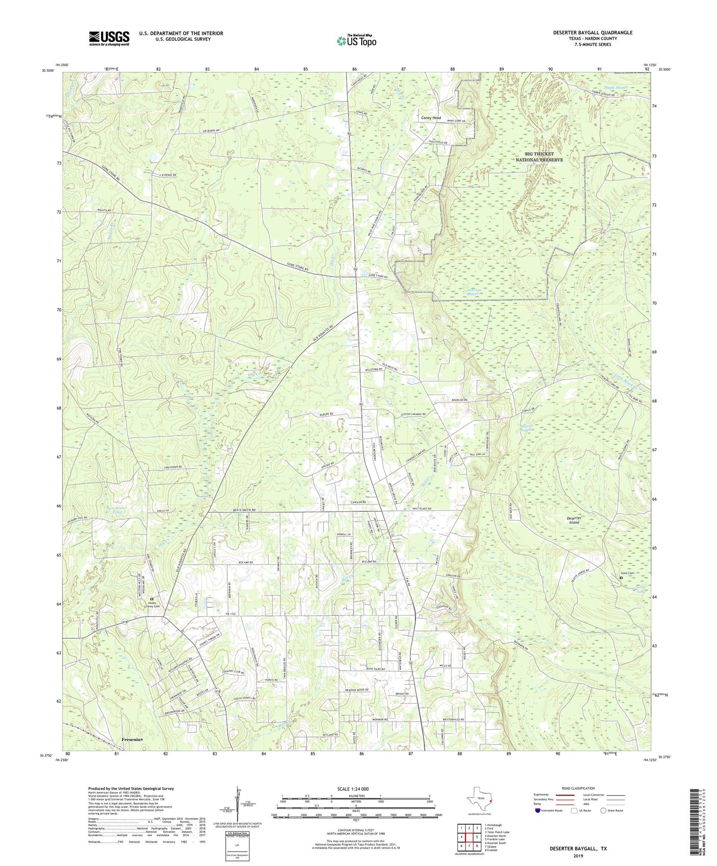
2019 topographic map quadrangle Deserter Baygall in the state of Texas. Scale: 1:24000. Based on the newly updated USGS 7.5' US Topo map series, this map is in the following counties: Hardin. The map contains contour data, water features, and other items you are used to seeing on USGS maps, but also has updated roads and other features. This is the next generation of topographic maps. Printed on high-quality waterproof paper with UV fade-resistant inks.
Quads adjacent to this one:
West: Kountze North
Northwest: Hicksbaugh
North: Fred
Northeast: Tater Patch Lake
East: Franklin Lake
Southeast: Evadale
South: Silsbee
Southwest: Kountze South
Contains the following named places: All Faith Tabernacle, Beech Creek Oil Field, Caney Head, Deserter Baygall, Deserter Island, Fresenius, Good Shepherd Church, Gore Cemetery, Gore Lake, Gore Oil Field, Hooks Cravey Cemetery, Jack Gore Baygall, North Silsbee Oil Field, Salt Water Pond, Silsbee Division, Silsbee Oil Field, Smart School, Smart School Fire Lookout Tower, South Hampton Oil and Gas Field, Transtar Emergency Medical Service, West Silsbee Oil Field, ZIP Code: 77656