MyTopo
Tater Patch Lake Texas US Topo Map
Couldn't load pickup availability
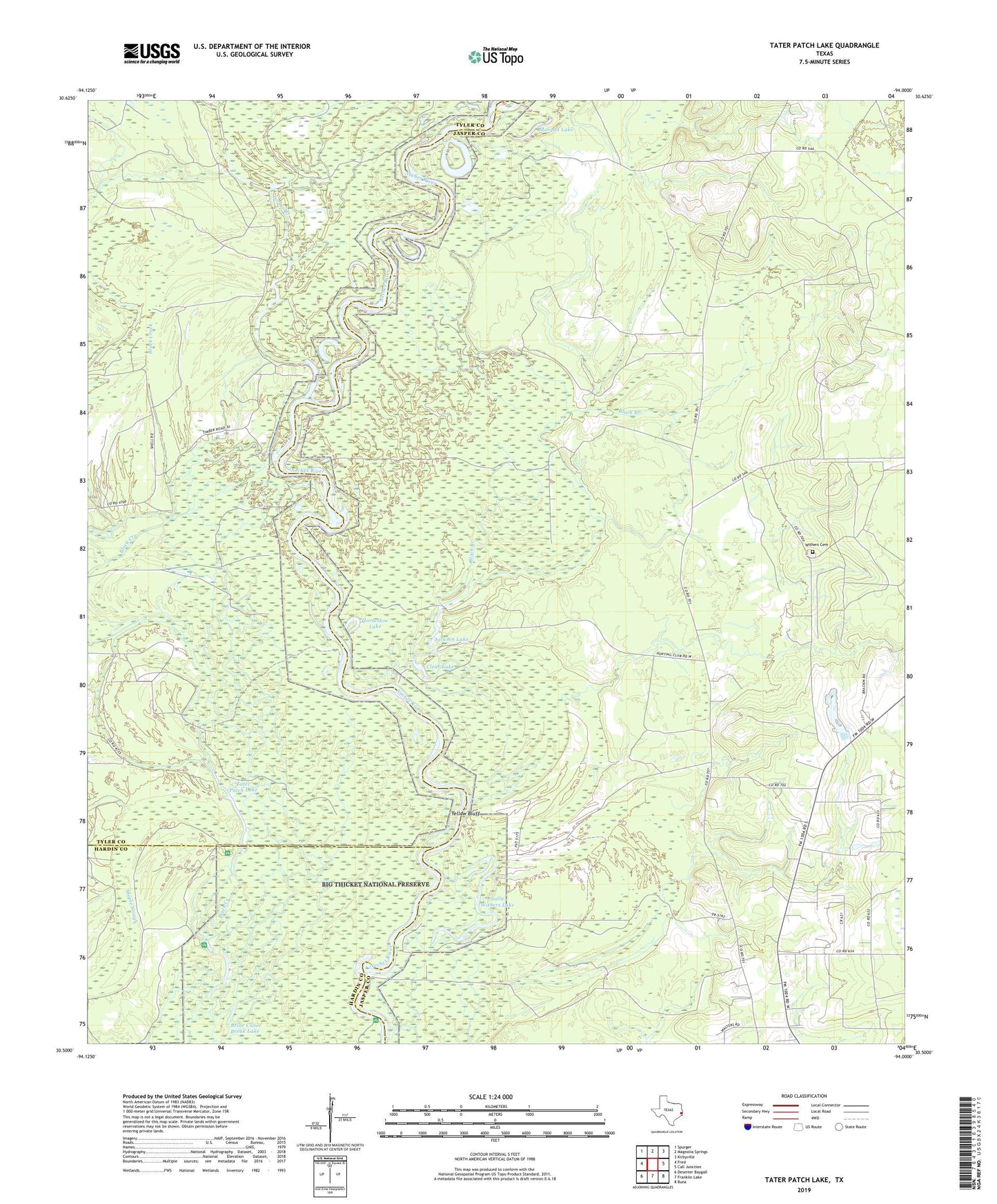
2022 topographic map quadrangle Tater Patch Lake in the state of Texas. Scale: 1:24000. Based on the newly updated USGS 7.5' US Topo map series, this map is in the following counties: Jasper, Tyler, Hardin. The map contains contour data, water features, and other items you are used to seeing on USGS maps, but also has updated roads and other features. This is the next generation of topographic maps. Printed on high-quality waterproof paper with UV fade-resistant inks.
Quads adjacent to this one:
West: Fred
Northwest: Spurger
North: Magnolia Springs
Northeast: Kirbyville
East: Call Junction
Southeast: Buna
South: Franklin Lake
Southwest: Deserter Baygall
Contains the following named places: Black Branch, Briar Cane Break Lake, Cairo Springs Church, Cairo Springs Lookout, Clear Lake, Fairview Church, Franks Branch, Horseshoe Lake, Jackson Lake, Maple Slough, McGallion Lake, Mill Creek, Morgan Lake, Sally Withers Lake, Sally Withers Lake Oil Field, Tater Patch Lake, Turner Branch, Withers Cemetery, Yellow Bluff