MyTopo
Dundee Texas US Topo Map
Couldn't load pickup availability
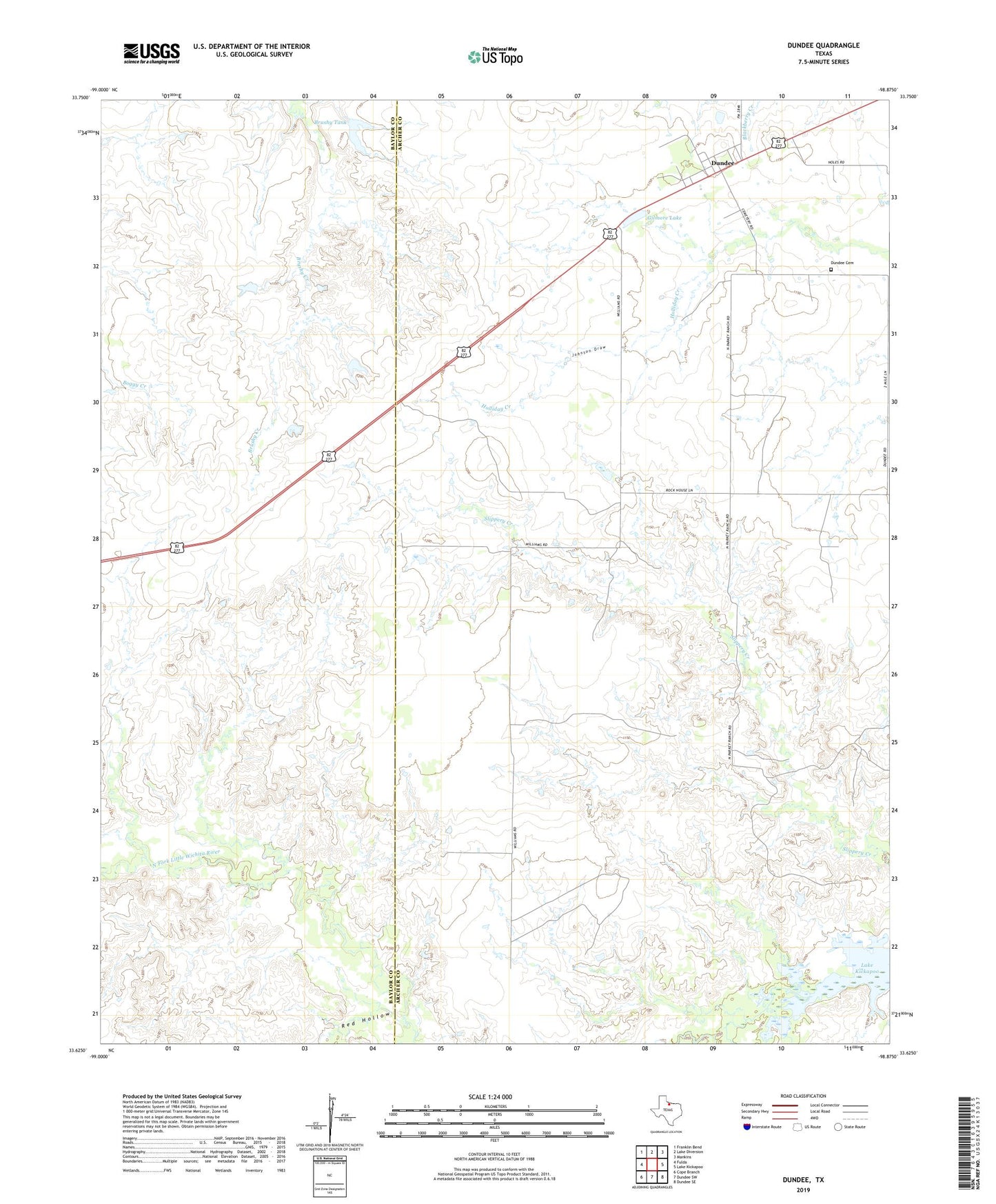
2019 topographic map quadrangle Dundee in the state of Texas. Scale: 1:24000. Based on the newly updated USGS 7.5' US Topo map series, this map is in the following counties: Archer, Baylor. The map contains contour data, water features, and other items you are used to seeing on USGS maps, but also has updated roads and other features. This is the next generation of topographic maps. Printed on high-quality waterproof paper with UV fade-resistant inks.
Quads adjacent to this one:
West: Fulda
Northwest: Franklin Bend
North: Lake Diversion
Northeast: Mankins
East: Lake Kickapoo
Southeast: Dundee SE
South: Dundee SW
Southwest: Cope Branch
Contains the following named places: Brushy Tank, Brushy Tank Dam, Dundee, Dundee Cemetery, Gilmore Lake, Gilmore Lake Dam, Johnson Draw, Red Hollow