MyTopo
Echo Texas US Topo Map
Couldn't load pickup availability
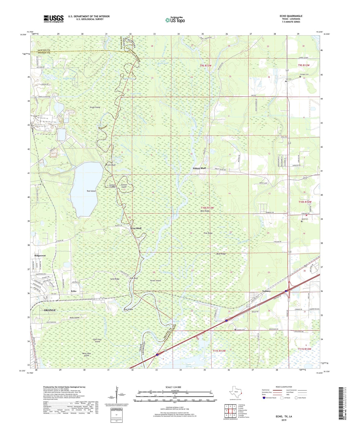
2019 topographic map quadrangle Echo in the states of Louisiana, Texas. Scale: 1:24000. Based on the newly updated USGS 7.5' US Topo map series, this map is in the following counties: Orange, Calcasieu, Newton. The map contains contour data, water features, and other items you are used to seeing on USGS maps, but also has updated roads and other features. This is the next generation of topographic maps. Printed on high-quality waterproof paper with UV fade-resistant inks.
Quads adjacent to this one:
West: Mauriceville
Northwest: Hartburg
North: Starks
Northeast: Lunita
East: Vinton
Southeast: Cameron Farms
South: Orange
Southwest: Orangefield
Contains the following named places: Beef Ridge, Big Bayou, Big Eddy, Blue Elbow, Bone Ridge, Brenam Bayou, Calcasieu Parish Ward 7 Fire Protection District, Canaan Primitive Baptist Church, City of Refuge Church, Comier Cemetery, Cooper Bayou, Cooper Lake, Cross Bayou, Crossroad Church, Dynamite Slough, East Cane Island, Echo, Granger Cemetery, Grubs Island, Gum Slough, Holden Slough, Horseshoe Lake, Indian Bayou, Jacks Island, Jackson Cutoff, Jackson Island, Lee Cemetery, Little Cypress Bayou, Lost Lake, Lundy Slough, Morgan Bluff, Morgan Eddy, Niblett Bluff, Nibletts Bluff Bible Church, Old River, Owens-Illinois Lake Dam, Owens-Illinois Reservoir, Pine Bluff, Pine Ridge, Pruitt Bluff, Pruitt Lake, Reed Cemetery, Ridgecrest, Sabine Island Wildlife Game Management Area, Sand Ridge, Swift Lake, Teal Island, Toomey, Tupelo Swamp, Turner Island, Watson Bayou, West Bluff, West Cane Island