MyTopo
Lunita Louisiana US Topo Map
Couldn't load pickup availability
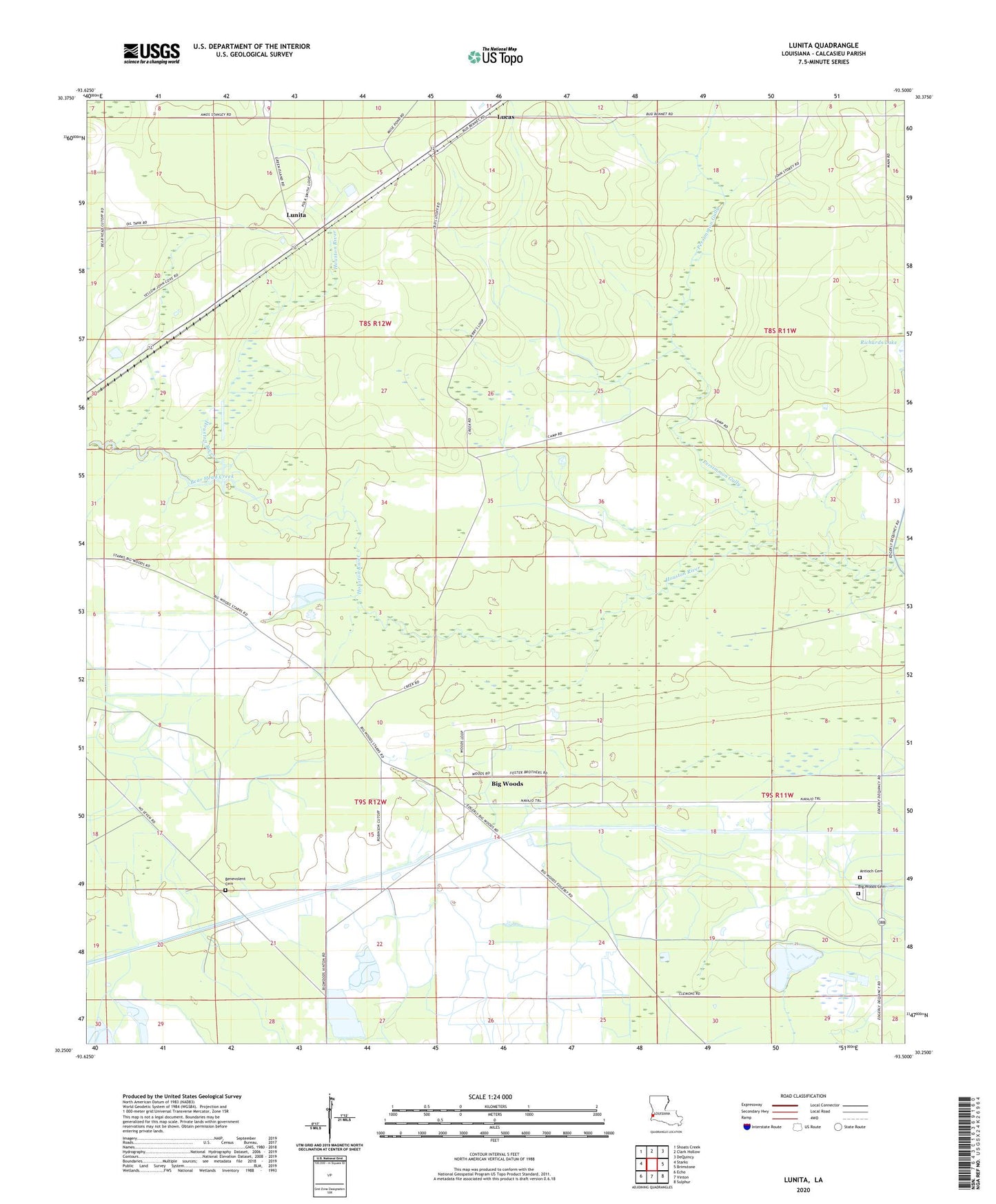
2024 topographic map quadrangle Lunita in the state of Louisiana. Scale: 1:24000. Based on the newly updated USGS 7.5' US Topo map series, this map is in the following counties: Calcasieu. The map contains contour data, water features, and other items you are used to seeing on USGS maps, but also has updated roads and other features. This is the next generation of topographic maps. Printed on high-quality waterproof paper with UV fade-resistant inks.
Quads adjacent to this one:
West: Starks
Northwest: Shoats Creek
North: Clark Hollow
Northeast: DeQuincy
East: Brimstone
Southeast: Sulphur
South: Vinton
Southwest: Echo
This map covers the same area as the classic USGS quad with code o30093c5.
Contains the following named places: Antioch Church, Bear Head Creek, Benevolent Cemetery, Big Woods, Big Woods Cemetery, KVHP-TV (Lake Charles), KYKZ-FM (Lake Charles), Lucas, Lunita, Magnolia Church, Parish Governing Authority District 11, Persimmon Gully, Sabine River Diversion System, Starks Compressor Station Heliport