MyTopo
Elderville Texas US Topo Map
Couldn't load pickup availability
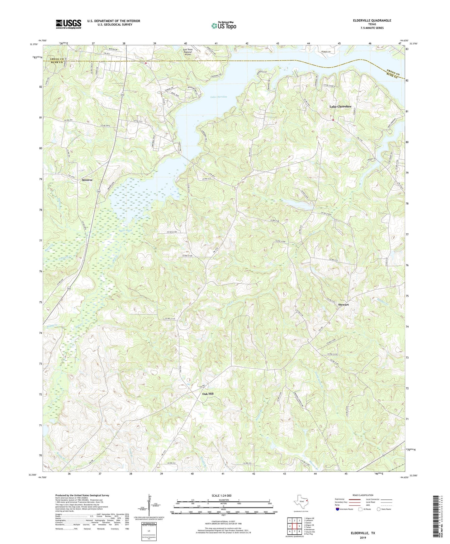
2019 topographic map quadrangle Elderville in the state of Texas. Scale: 1:24000. Based on the newly updated USGS 7.5' US Topo map series, this map is in the following counties: Rusk, Gregg. The map contains contour data, water features, and other items you are used to seeing on USGS maps, but also has updated roads and other features. This is the next generation of topographic maps. Printed on high-quality waterproof paper with UV fade-resistant inks.
Quads adjacent to this one:
West: Kilgore SE
Northwest: Kilgore NE
North: Lakeport
Northeast: Easton
East: Tatum
Southeast: Fair Play
South: Church Hill
Southwest: Henderson
Contains the following named places: Bacon Creek, Barnes Creek, Beaver Marsh, Bethel Church, Boggy Creek, Chalk Hill, Champion Emergency Medical Service, Elderville, Elderville - Lakeport Volunteer Fire Department Station 1, Elderville - Lakeport Volunteer Fire Department Station 3, Freedonia Church, Lake Cherokee, Lake Cherokee Census Designated Place, Lakeview Church, Lee Creek, Long Glade Lake, Long Glade Lake Dam, Mason Lake, Mason Lake Levee, Mill Creek, Millville Church, Monroe, Nix Dam, Oak Hill, Stewart, Stewart Cemetery, Tiawichi Creek, Todd Branch, Waters Chapel