MyTopo
Church Hill Texas US Topo Map
Couldn't load pickup availability
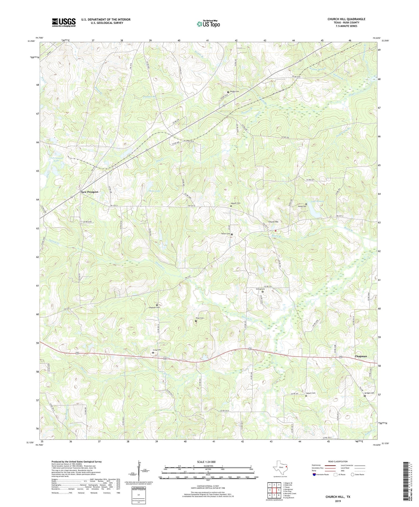
2022 topographic map quadrangle Church Hill in the state of Texas. Scale: 1:24000. Based on the newly updated USGS 7.5' US Topo map series, this map is in the following counties: Rusk. The map contains contour data, water features, and other items you are used to seeing on USGS maps, but also has updated roads and other features. This is the next generation of topographic maps. Printed on high-quality waterproof paper with UV fade-resistant inks.
Quads adjacent to this one:
West: Henderson
Northwest: Kilgore SE
North: Elderville
Northeast: Tatum
East: Fair Play
Southeast: Long Branch
South: Minden
Southwest: Berryhill Creek
This map covers the same area as the classic USGS quad with code o32094b6.
Contains the following named places: Andy Young Branch, Antioch Cemetery, Antioch School, Bridges Cemetery, Chapman, Chapman Cemetery, Church Hill, Church Hill School, Church Hill Volunteer Fire Department, Craig Cemetery, Dorsett Creek, Dry Creek, Hallum Cemetery, Lake Roman, Lincoln Church, Mount Arat Church, Mount Vernon Baptist Church, New Prospect, New Prospect Church, Nix Lake, Oakland Church, Prospect Branch, Pryor Cemetery, Roman Lake Dam, Shaw Lake, Shaw Lake Dam, Strong Cemetery, Swiley Lake, Swiley Lake Dam, T P Cannon Lake, T P Cannon Lake Dam, Tenny Lewis Branch, Turner Cemetery, Wasson Cemetery, Willow Springs Church, Wright Branch, Wright Cemetery, Young Cemetery, ZIP Code: 75652