MyTopo
Eldorado NE Texas US Topo Map
Couldn't load pickup availability
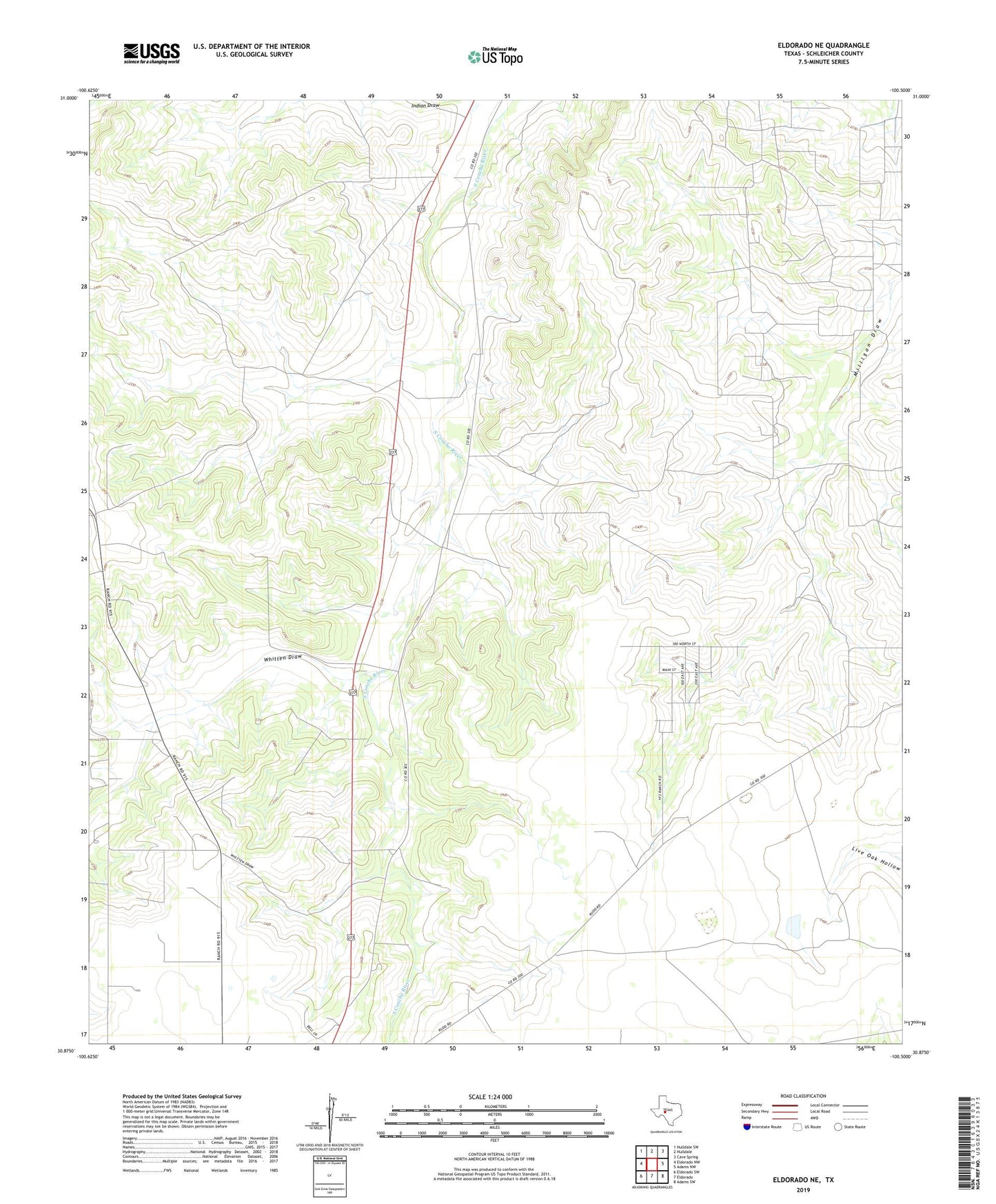
2019 topographic map quadrangle Eldorado NE in the state of Texas. Scale: 1:24000. Based on the newly updated USGS 7.5' US Topo map series, this map is in the following counties: Schleicher. The map contains contour data, water features, and other items you are used to seeing on USGS maps, but also has updated roads and other features. This is the next generation of topographic maps. Printed on high-quality waterproof paper with UV fade-resistant inks.
Quads adjacent to this one:
West: Eldorado NW
Northwest: Hulldale SW
North: Hulldale
Northeast: Cave Spring
East: Adams NW
Southeast: Adams SW
South: Eldorado
Southwest: Eldorado SW
Contains the following named places: Fundamentalist Church of Jesus Christ Cemetery, Hulldale Oil Field, Latin Cemetery, Schleicher County, Schleicher County Historical Society Museum, Whitten Draw, Yearning for Zion Ranch, ZIP Code: 76936