MyTopo
Hulldale Texas US Topo Map
Couldn't load pickup availability
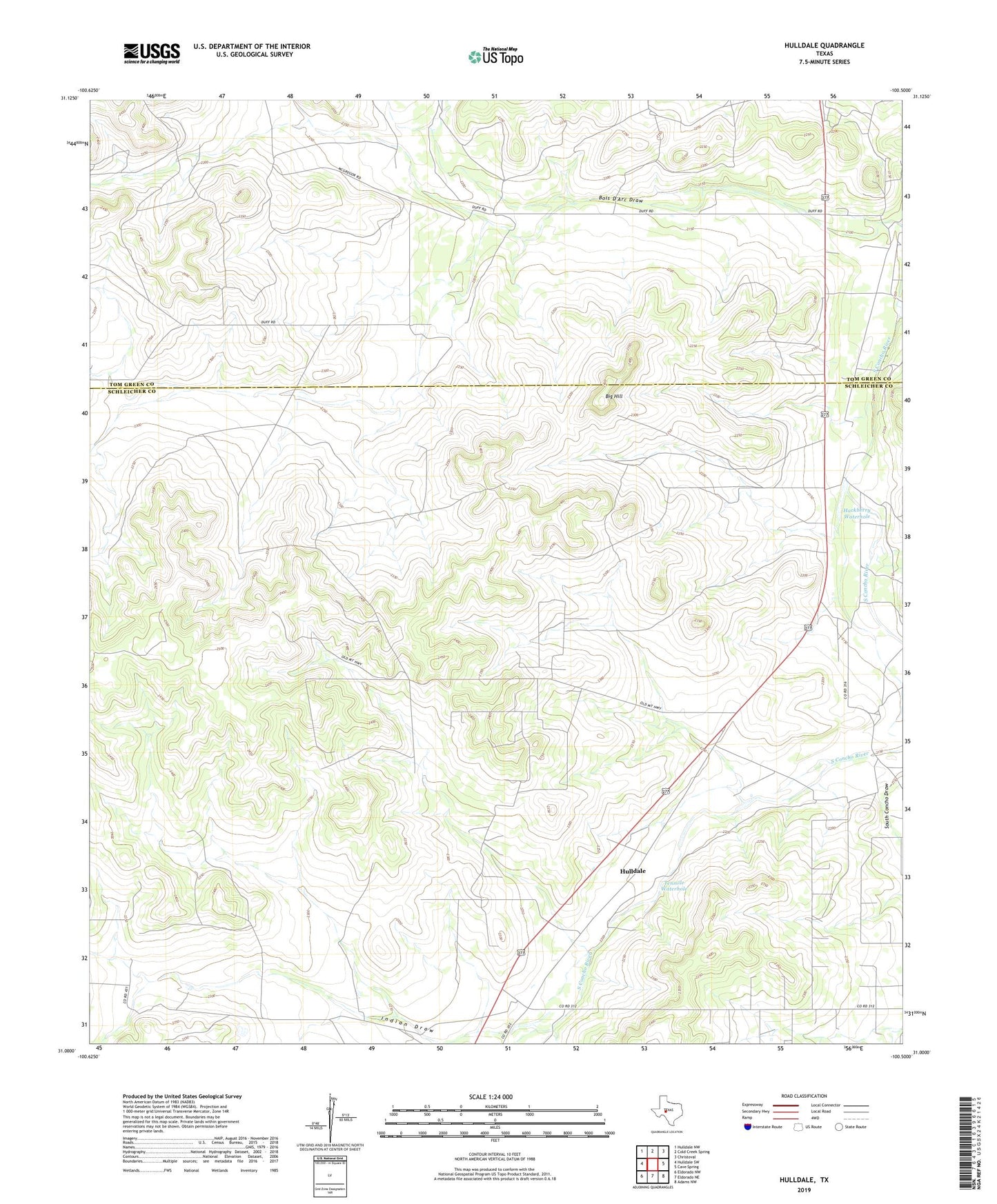
2022 topographic map quadrangle Hulldale in the state of Texas. Scale: 1:24000. Based on the newly updated USGS 7.5' US Topo map series, this map is in the following counties: Schleicher, Tom Green. The map contains contour data, water features, and other items you are used to seeing on USGS maps, but also has updated roads and other features. This is the next generation of topographic maps. Printed on high-quality waterproof paper with UV fade-resistant inks.
Quads adjacent to this one:
West: Hulldale SW
Northwest: Hulldale NW
North: Cold Creek Spring
Northeast: Christoval
East: Cave Spring
Southeast: Adams NW
South: Eldorado NE
Southwest: Eldorado NW
This map covers the same area as the classic USGS quad with code o31100a5.
Contains the following named places: Big Hill, Hackberry Waterhole, HJ Oil and Gas Field, Hulldale, Indian Draw, Neva West Oil and Gas Field, Tenmile Waterhole