MyTopo
Eliasville Texas US Topo Map
Couldn't load pickup availability
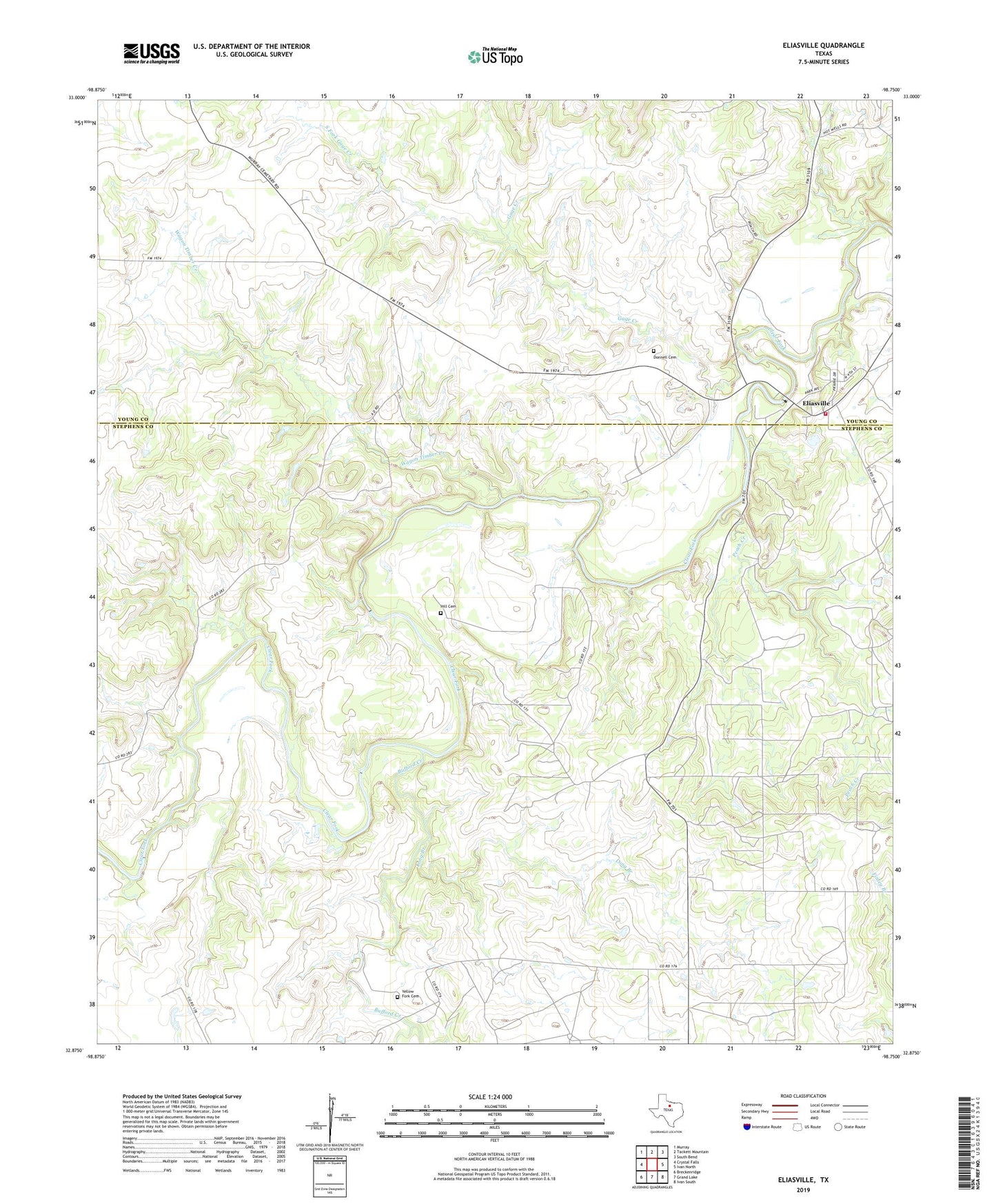
2019 topographic map quadrangle Eliasville in the state of Texas. Scale: 1:24000. Based on the newly updated USGS 7.5' US Topo map series, this map is in the following counties: Stephens, Young. The map contains contour data, water features, and other items you are used to seeing on USGS maps, but also has updated roads and other features. This is the next generation of topographic maps. Printed on high-quality waterproof paper with UV fade-resistant inks.
Quads adjacent to this one:
West: Crystal Falls
Northwest: Murray
North: Tackett Mountain
Northeast: South Bend
East: Ivan North
Southeast: Ivan South
South: Grand Lake
Southwest: Breckenridge
Contains the following named places: A A Atkins Lake Dam, A A Atkins Reservoir, Bufford Creek, Donnell Cemetery, East Fork Bufford Creek, Eliasville, Gage Creek, Hill Cemetery, Hill Oil Field, Humble Dam, Humble Lake, Humble Lake Dam, Long Branch, Old Eureka Mill Reservoir, Old Eureka Mill Reservoir Dam, Peach Creek, South Fork Gage Creek, Texas Company Lake Dam, Texas Company Reservoir, Texas Dam, Wagon Timber Creek, West Fork Bufford Creek, Yellow Fork Cemetery, Young County Rural Volunteer Fire Department Station 4