MyTopo
Estelline Texas US Topo Map
Couldn't load pickup availability
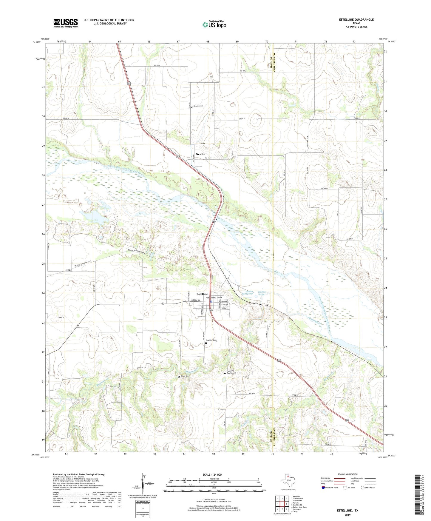
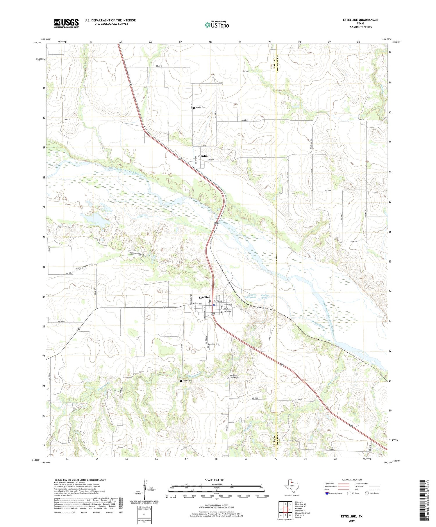
2019 topographic map quadrangle Estelline in the state of Texas. Scale: 1:24000. Based on the newly updated USGS 7.5' US Topo map series, this map is in the following counties: Hall, Childress. The map contains contour data, water features, and other items you are used to seeing on USGS maps, but also has updated roads and other features. This is the next generation of topographic maps. Printed on high-quality waterproof paper with UV fade-resistant inks.
Quads adjacent to this one:
West: Parnell
Northwest: Memphis
North: Estelline NW
Northeast: Estelline NE
East: Estelline SE
Southeast: Carey
South: Tell North
Southwest: Badger Nest Tank
Contains the following named places: Dillon Cemetery, Estelline, Estelline Cemetery, Estelline City Hall, Estelline Police Department, Estelline Post Office, Estelline Salt Springs, Estelline Spring, Hutchins Family Cemetery, Mountain Creek, Newlin, Newlin Cemetery, Old Gilpin School, Plains Junction, Rustlers Creek, Town of Estelline