MyTopo
Fannett East Texas US Topo Map
Couldn't load pickup availability
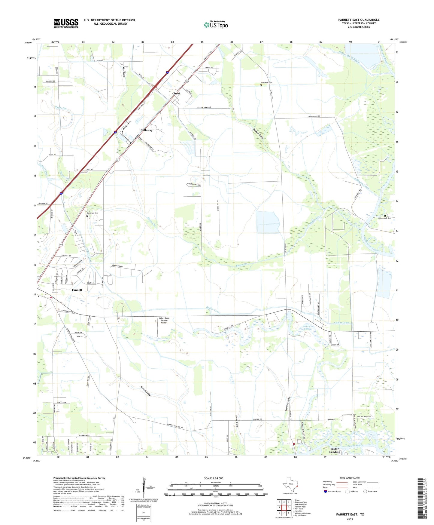
2019 topographic map quadrangle Fannett East in the state of Texas. Scale: 1:24000. Based on the newly updated USGS 7.5' US Topo map series, this map is in the following counties: Jefferson. The map contains contour data, water features, and other items you are used to seeing on USGS maps, but also has updated roads and other features. This is the next generation of topographic maps. Printed on high-quality waterproof paper with UV fade-resistant inks.
Quads adjacent to this one:
West: Fannett West
Northwest: China
North: Beaumont West
Northeast: Beaumont East
East: Port Acres
Southeast: Big Hill Bayou
South: Alligator Hole Marsh
Southwest: Hamshire
Contains the following named places: Bayou Din, Bayou Din Golf Club, Boyt Lake, Broussard Cemetery, Cheek, Fannett Census Designated Place, Fannett Church of Christ, Fannett School, Galloway, Hillebrandt Cemetery, Jefferson Canal, Kelley Crop Service Airport, Kidd Gully, La Belle, Labelle - Fannett Volunteer Fire Department / Emergency Medical Services Substation, Labelle Division, Labelle Fannett Volunteer Fire Department, Landrum Cemetery, Lovell Lake, Lovell Lake Oil Field, Pevitot Gully, Port Arthur Country Club, Red Haw Gully, Spindletop-Gladys City Boomtown Museum, Willow Marsh Bayou, ZIP Code: 77705