MyTopo
Hamshire Texas US Topo Map
Couldn't load pickup availability
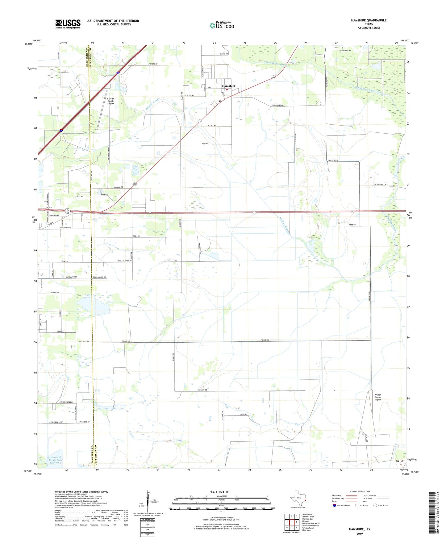
2022 topographic map quadrangle Hamshire in the state of Texas. Scale: 1:24000. Based on the newly updated USGS 7.5' US Topo map series, this map is in the following counties: Jefferson, Chambers. The map contains contour data, water features, and other items you are used to seeing on USGS maps, but also has updated roads and other features. This is the next generation of topographic maps. Printed on high-quality waterproof paper with UV fade-resistant inks.
Quads adjacent to this one:
West: Stowell
Northwest: Winnie NW
North: Fannett West
Northeast: Fannett East
East: Alligator Hole Marsh
Southeast: Star Lake
South: Whites Ranch
Southwest: Stanolind Reservoir
This map covers the same area as the classic USGS quad with code o29094g3.
Contains the following named places: Big Hill Oil Field, Fannett Oil Field, Griffith Ranch Airport, Hamshire, Hamshire - Fannett High School, Hamshire Census Designated Place, Hamshire Post Office, Hamshire Volunteer Fire Department, Marshall Estate Lake Number 2, South Stowell Oil Field, Stowell Oil Field, Wilber Farms Airport, Woodrow Cemetery, ZIP Code: 77622