MyTopo
Fly Gap Texas US Topo Map
Couldn't load pickup availability
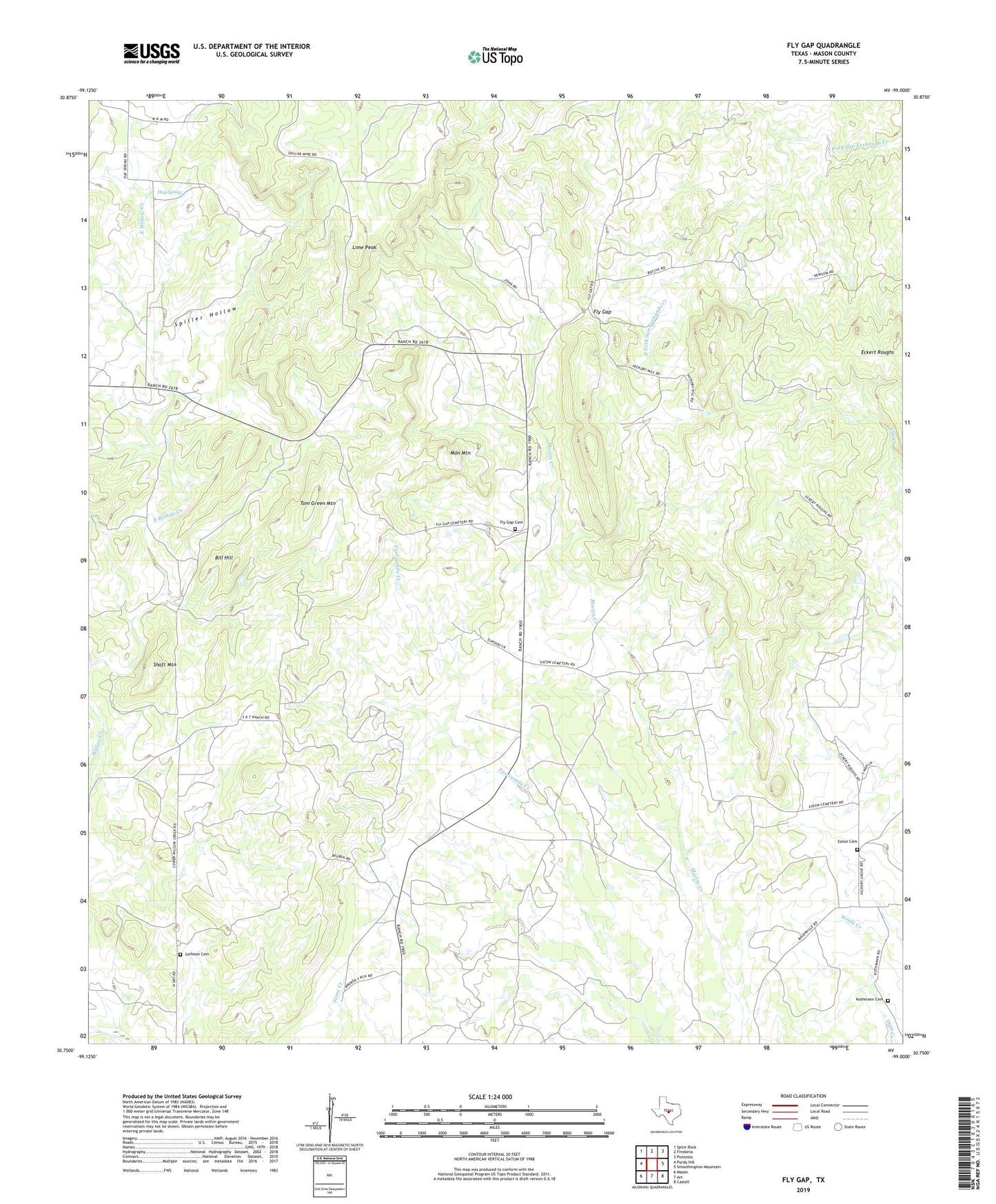
2019 topographic map quadrangle Fly Gap in the state of Texas. Scale: 1:24000. Based on the newly updated USGS 7.5' US Topo map series, this map is in the following counties: Mason. The map contains contour data, water features, and other items you are used to seeing on USGS maps, but also has updated roads and other features. This is the next generation of topographic maps. Printed on high-quality waterproof paper with UV fade-resistant inks.
Quads adjacent to this one:
West: Purdy Hill
Northwest: Spice Rock
North: Fredonia
Northeast: Pontotoc
East: Smoothingiron Mountain
Southeast: Castell
South: Art
Southwest: Mason
Contains the following named places: Bill Hill, East Willow Creek, Eaton Cemetery, Eckert Roughs, Fly Gap, Fly Gap Cemetery, Fly Gap School, Hanie Mine, Hasse Creek, Hay Spring, Kothmann Cemetery, Leifeste Cemetery, Lime Peak, Man Mountain, Mason East Division, Shaft Mountain, Spiller Hollow, Spiller Mine, Tom Green Mountain, ZIP Code: 76820