MyTopo
Castell Texas US Topo Map
Couldn't load pickup availability
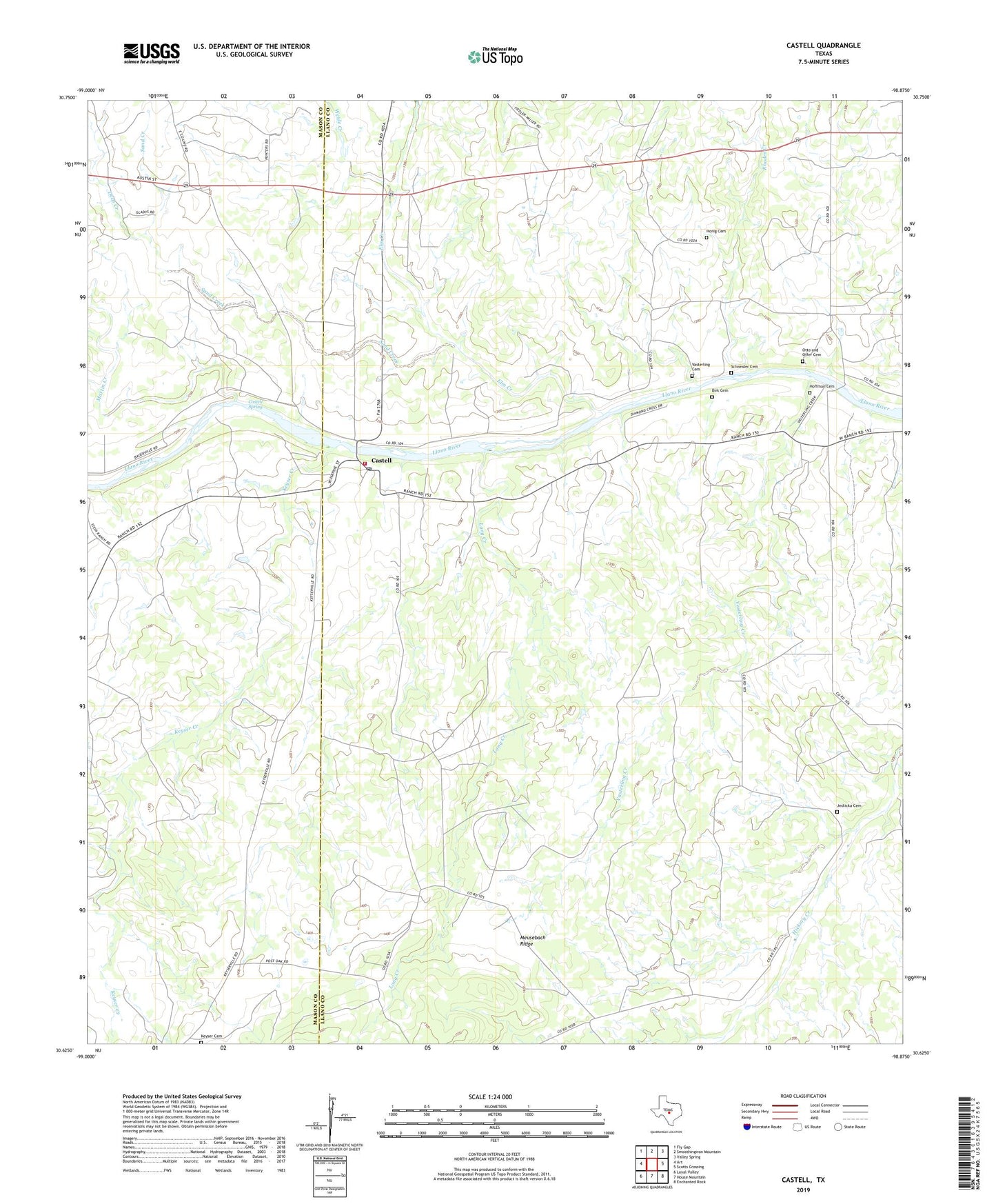
2022 topographic map quadrangle Castell in the state of Texas. Scale: 1:24000. Based on the newly updated USGS 7.5' US Topo map series, this map is in the following counties: Llano, Mason. The map contains contour data, water features, and other items you are used to seeing on USGS maps, but also has updated roads and other features. This is the next generation of topographic maps. Printed on high-quality waterproof paper with UV fade-resistant inks.
Quads adjacent to this one:
West: Art
Northwest: Fly Gap
North: Smoothingiron Mountain
Northeast: Valley Spring
East: Scotts Crossing
Southeast: Enchanted Rock
South: House Mountain
Southwest: Loyal Valley
This map covers the same area as the classic USGS quad with code o30098f8.
Contains the following named places: Birk Cemetery, Castell, Castell Post Office, Castell Spring, Castell Volunteer Fire Department, Deep Creek, Elm Creek, Hoffman Cemetery, Honig Cemetery, House Mountain Branch, Jedlicka Cemetery, Keyser Cemetery, Keyser Creek, Lang Creek, Martin Creek, Meusebach Ridge, Otto and Offer Cemetery, Rhodes Creek, Saint Johns Church, Sand Creek, Schneider Cemetery, Vasterling Cemetery, Vasterling Creek, Weide Creek, ZIP Code: 76831