MyTopo
Forney North Texas US Topo Map
Couldn't load pickup availability
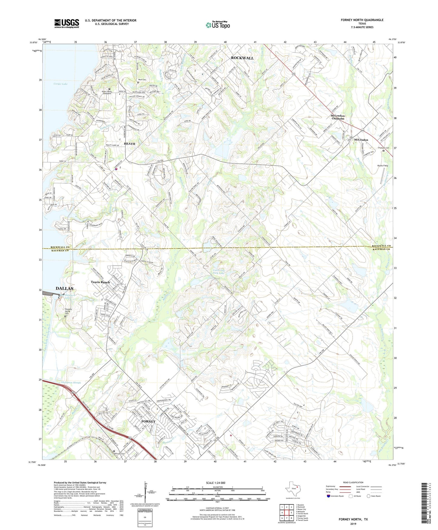
2019 topographic map quadrangle Forney North in the state of Texas. Scale: 1:24000. Based on the newly updated USGS 7.5' US Topo map series, this map is in the following counties: Kaufman, Rockwall. The map contains contour data, water features, and other items you are used to seeing on USGS maps, but also has updated roads and other features. This is the next generation of topographic maps. Printed on high-quality waterproof paper with UV fade-resistant inks.
Quads adjacent to this one:
West: Mesquite
Northwest: Rowlett
North: Rockwall
Northeast: Royse City
East: Terrell North
Southeast: Terrell South
South: Forney South
Southwest: Seagoville
Contains the following named places: Amy Parks - Heath Elementary School, Berry Creek, Brockway Branch, Brushy Creek, Chisholm Cemetery, City of Heath, City of McLendon-Chisholm, First Baptist Church - Heath, Hackberry Creek, Heath, Heath City Hall, Heath Fire Department, Heath Police Department, Hillcrest Cemetery, Holy Trinity Episcopal Church, Klutts Field, Kyser Cemetery, Lagrone Ranch Airport, Little Buffalo Creek, Long Branch, McLendon, McLendon - Chisholm City Hall, McLendon-Chisholm, Mount Rose Church, Peck Cemetery, Pleasant Spring Cemetery, Ray Hubbard Lake, Soil Conservation Service Site 10 Dam, Soil Conservation Service Site 10 Reservoir, Soil Conservation Service Site 14a Dam, Soil Conservation Service Site 14a Reservoir, Soil Conservation Service Site 15 Dam, Soil Conservation Service Site 15 Reservoir, Soil Conservation Service Site 18 Dam, Soil Conservation Service Site 18 Reservoir, Soil Conservation Service Site 19 Dam, Soil Conservation Service Site 19 Reservoir, Soil Conservation Service Site 21a Dam, Soil Conservation Service Site 21a Reservoir, Soil Conservation Service Site 6 Dam, Soil Conservation Service Site 6 Reservoir, Soil Conservation Service Site 7 Dam, Soil Conservation Service Site 7 Reservoir, Soil Conservation Service Site 8 Dam, Soil Conservation Service Site 8 Reservoir, Soil Conservation Service Site 9 Dam, Soil Conservation Service Site 9 Reservoir, Soil Conservation Service Site 9a Dam, Soil Conservation Service Site 9a Reservoir, South Rockwall Division, Thompson Slough, Travis Ranch Census Designated Place, University Park Lake, University Park Lake Dam, ZIP Code: 75032