MyTopo
Royse City Texas US Topo Map
Couldn't load pickup availability
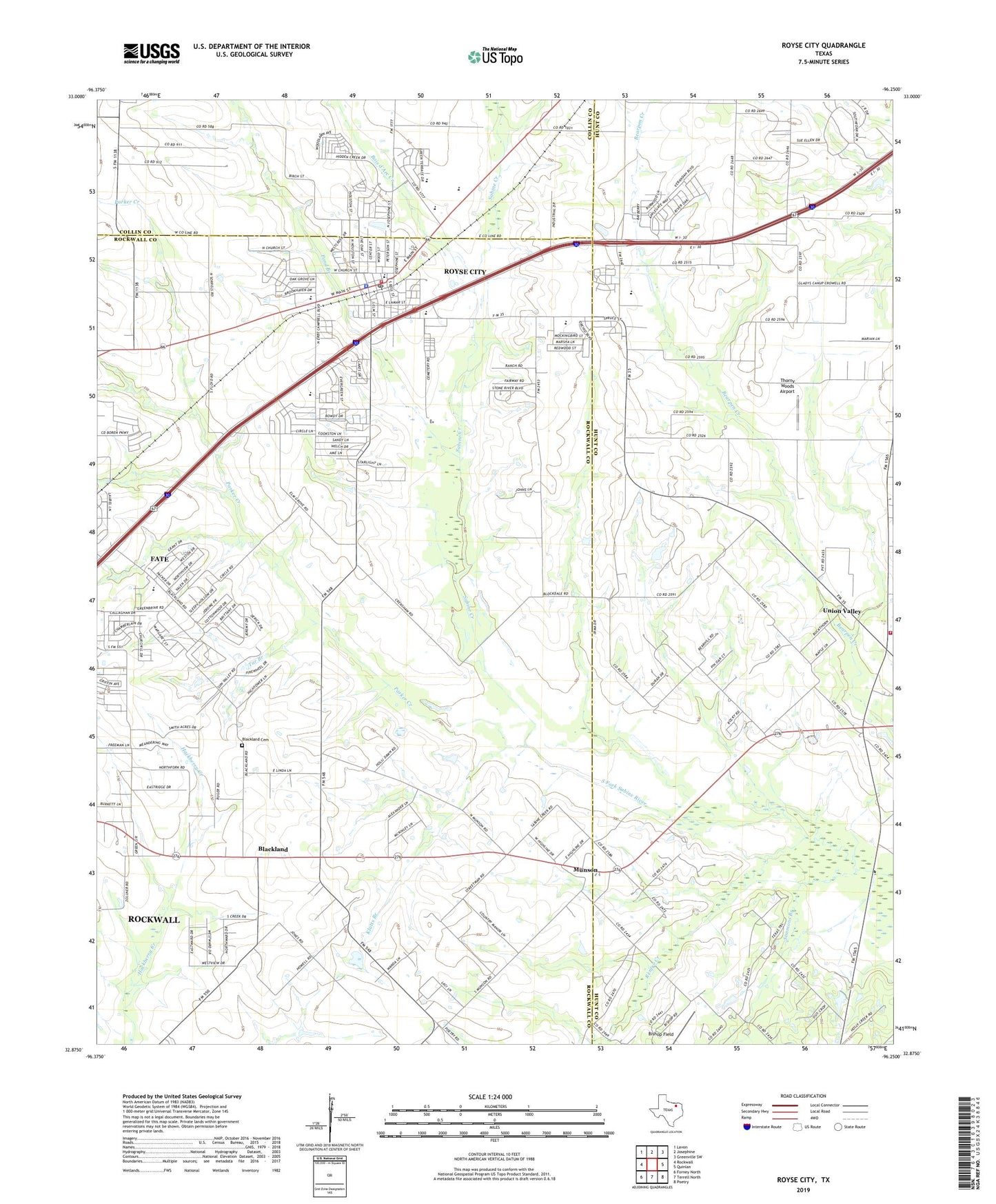
2022 topographic map quadrangle Royse City in the state of Texas. Scale: 1:24000. Based on the newly updated USGS 7.5' US Topo map series, this map is in the following counties: Rockwall, Hunt, Collin. The map contains contour data, water features, and other items you are used to seeing on USGS maps, but also has updated roads and other features. This is the next generation of topographic maps. Printed on high-quality waterproof paper with UV fade-resistant inks.
Quads adjacent to this one:
West: Rockwall
Northwest: Lavon
North: Josephine
Northeast: Greenville SW
East: Quinlan
Southeast: Poetry
South: Terrell North
Southwest: Forney North
This map covers the same area as the classic USGS quad with code o32096h3.
Contains the following named places: Bishop Field, Blackland, Blackland Cemetery, Bois d'Arc Creek, Bulldog Stadium, Bunche School, Church of Christ Royce City, City of Royse City, H H Browning Primary School, Klutts Branch, Munson, New Hope Baptist Church, Northeast Rockwall Division, Parker Creek, Pond Branch, Renfro Creek, Royse City, Royse City City Hall, Royse City Elementary School, Royse City Fire Department, Royse City High School, Royse City Lodge Number 663, Royse City Middle School, Royse City Police Department, Royse City Post Office, Sabine Creek, Simmons Branch, Tar Branch, Thorny Woods Airport, Union Valley, Union Valley City Hall, Union Valley Volunteer Fire Department, ZIP Codes: 75132, 75189