MyTopo
Fred Texas US Topo Map
Couldn't load pickup availability
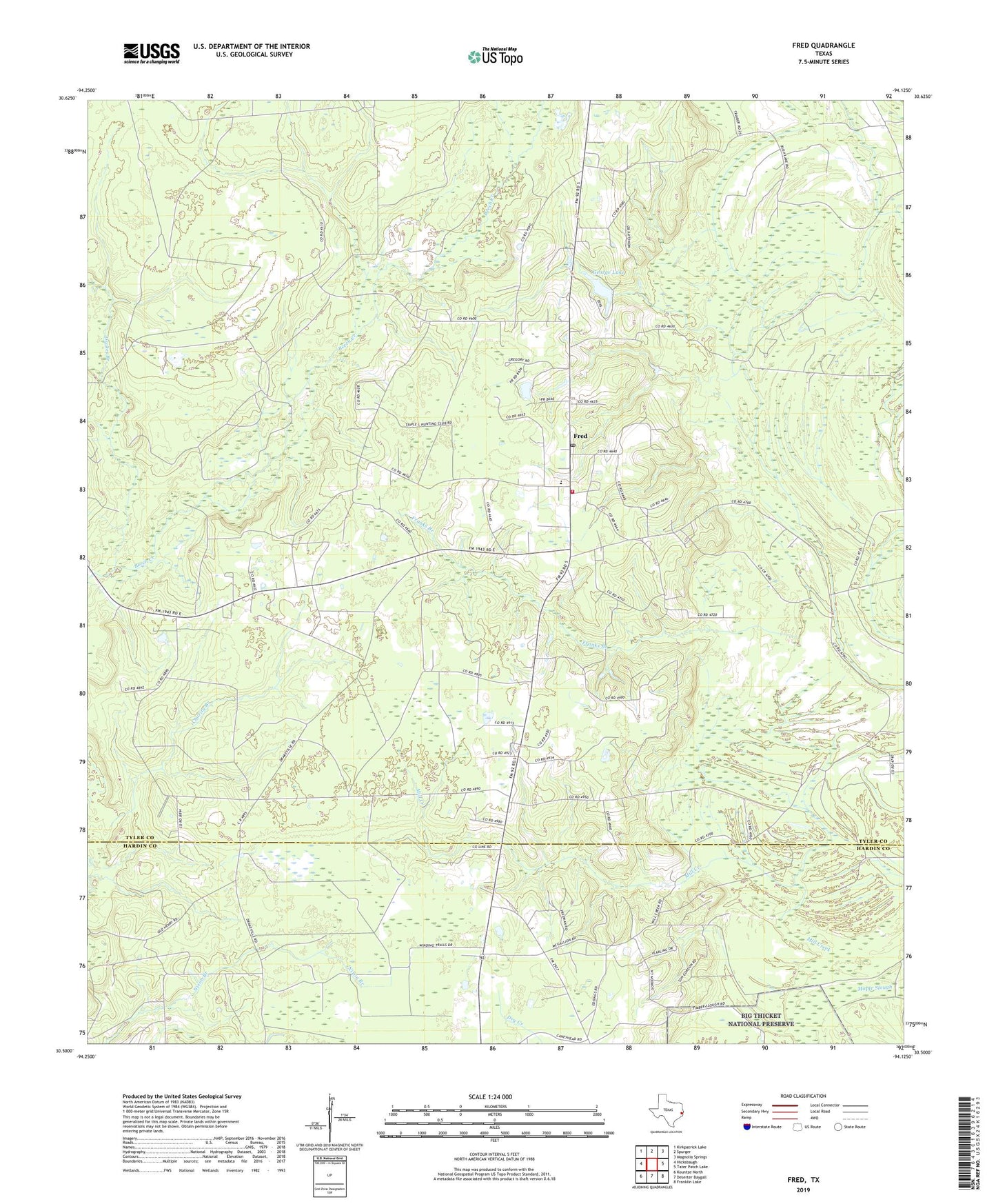
2019 topographic map quadrangle Fred in the state of Texas. Scale: 1:24000. Based on the newly updated USGS 7.5' US Topo map series, this map is in the following counties: Tyler, Hardin. The map contains contour data, water features, and other items you are used to seeing on USGS maps, but also has updated roads and other features. This is the next generation of topographic maps. Printed on high-quality waterproof paper with UV fade-resistant inks.
Quads adjacent to this one:
West: Hicksbaugh
Northwest: Kirkpatrick Lake
North: Spurger
Northeast: Magnolia Springs
East: Tater Patch Lake
Southeast: Franklin Lake
South: Deserter Baygall
Southwest: Kountze North
Contains the following named places: Charity Branch, Cunningham Chapel, Drakes Branch, East Beech Creek Oil Field, Fortenberry West Oil Field, Franks Branch Church, Fred, Fred Post Office, Fred Volunteer Fire Department, George Lake, George Lake Dam, Jackson-Doty Oil Field, Mount Nebo Church, Oak Grove Church, United Church, ZIP Code: 77616