
MyTopo
Gentrys Mill Texas US Topo Map
Couldn't load pickup availability
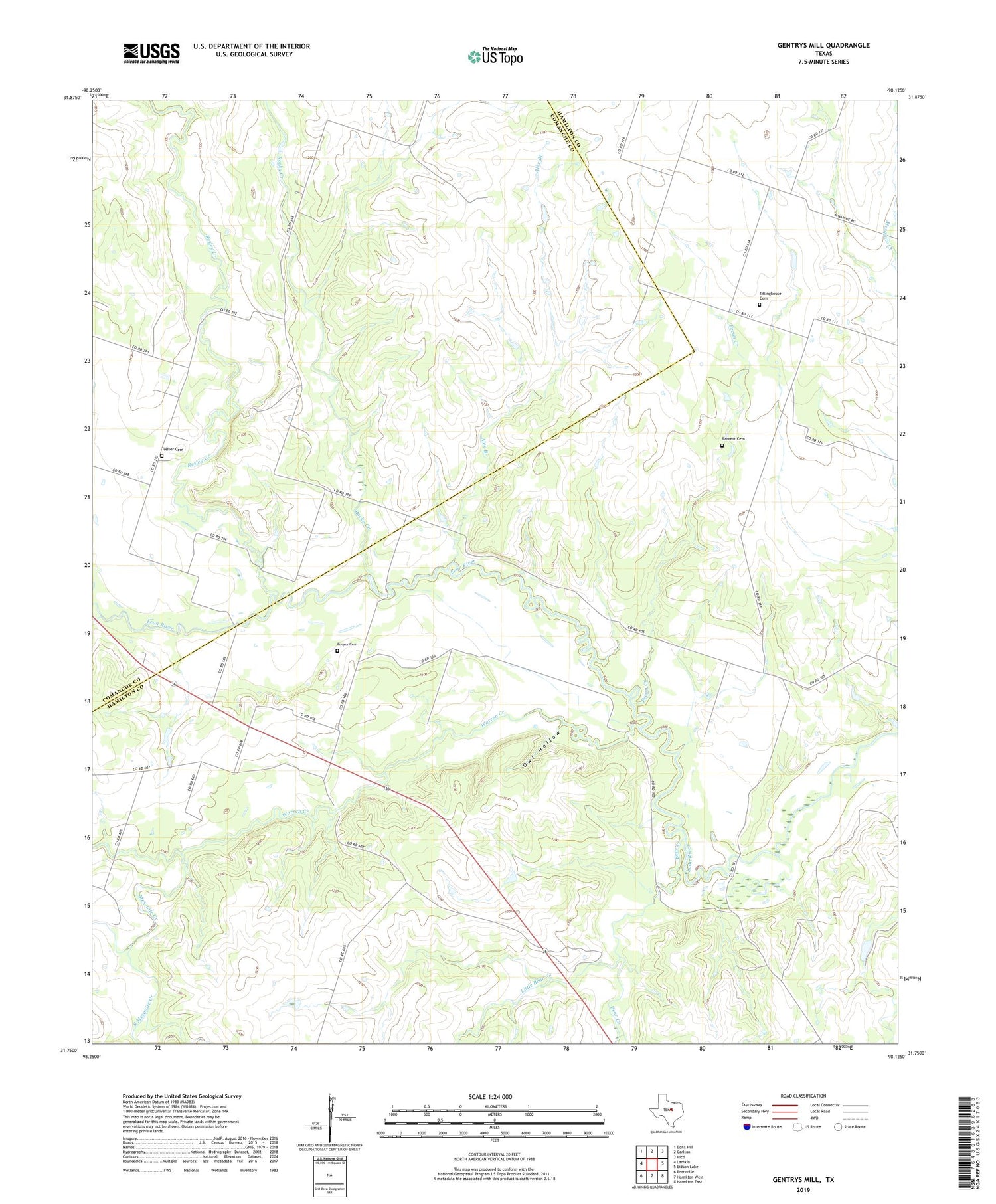
2019 topographic map quadrangle Gentrys Mill in the state of Texas. Scale: 1:24000. Based on the newly updated USGS 7.5' US Topo map series, this map is in the following counties: Hamilton, Comanche. The map contains contour data, water features, and other items you are used to seeing on USGS maps, but also has updated roads and other features. This is the next generation of topographic maps. Printed on high-quality waterproof paper with UV fade-resistant inks.
Quads adjacent to this one:
West: Lamkin
Northwest: Edna Hill
North: Carlton
Northeast: Hico
East: Eidson Lake
Southeast: Hamilton East
South: Hamilton West
Southwest: Pottsville
Contains the following named places: Alex Branch, Barnett Cemetery, Bear Creek, Fequa Cemetery, Gentrys Mill, Gentrys Mill Church, Little Bear Creek, Mesquite Creek, Owl Hollow, Pecan Creek, Resley Creek, Rocky Creek, South Mesquite Creek, Springtown, Spurlin, Sunshine, Tillinghouse Cemetery, Toliver Cemetery, Warren Creek, Warren Creek Church, ZIP Code: 76436


