MyTopo
Pottsville Texas US Topo Map
Couldn't load pickup availability
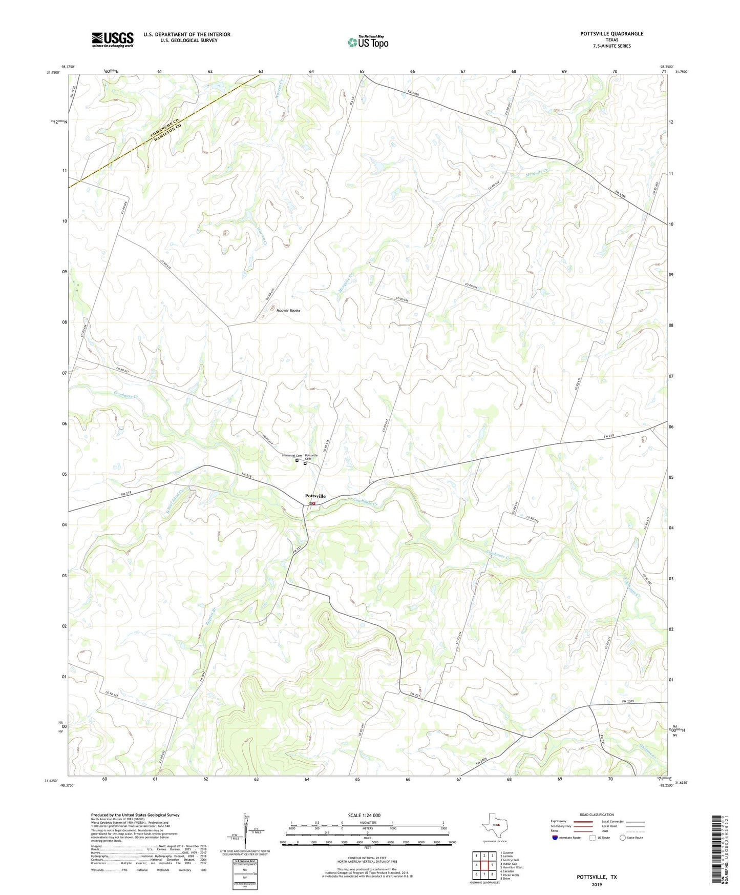
2022 topographic map quadrangle Pottsville in the state of Texas. Scale: 1:24000. Based on the newly updated USGS 7.5' US Topo map series, this map is in the following counties: Hamilton, Comanche. The map contains contour data, water features, and other items you are used to seeing on USGS maps, but also has updated roads and other features. This is the next generation of topographic maps. Printed on high-quality waterproof paper with UV fade-resistant inks.
Quads adjacent to this one:
West: Indian Gap
Northwest: Gustine
North: Lamkin
Northeast: Gentrys Mill
East: Hamilton West
Southeast: Shive
South: Pecan Wells
Southwest: Caradan
This map covers the same area as the classic USGS quad with code o31098f3.
Contains the following named places: Baptist Branch, Hoover Knobs, Immanuel Cemetery, Immanuel Church, Pottsville, Pottsville Cemetery, Pottsville Fire Department, Pottsville Post Office, School Land Creek, ZIP Codes: 76452, 76565