MyTopo
Grayton Lake Texas US Topo Map
Couldn't load pickup availability
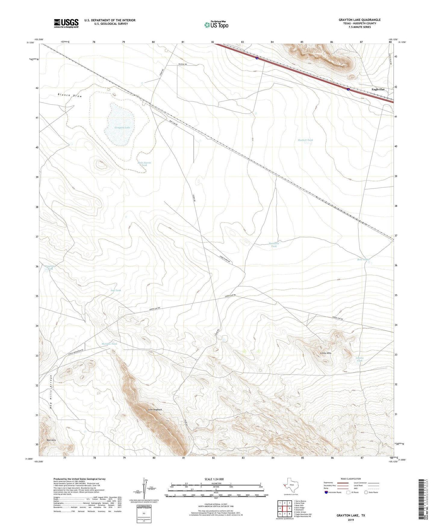
2019 topographic map quadrangle Grayton Lake in the state of Texas. Scale: 1:24000. Based on the newly updated USGS 7.5' US Topo map series, this map is in the following counties: Hudspeth. The map contains contour data, water features, and other items you are used to seeing on USGS maps, but also has updated roads and other features. This is the next generation of topographic maps. Printed on high-quality waterproof paper with UV fade-resistant inks.
Quads adjacent to this one:
West: Devil Ridge
Northwest: Sierra Blanca
North: Dome Peak
Northeast: Bean Hills
East: Allamoore
Southeast: Eagle Mountains NE
South: Eagle Mountains NW
Southwest: Cedar Arroyo
Contains the following named places: Blanca Draw, Bola Tank, Eagle Flat, Grayton Lake, Hackett Tank, Isbell Ranch, Jack Jolly Camp, Jug Tank, Little Hills, Lomita Tank, Love Hogback, Malo Suerte Tank, McAdoo Tank, Partition Tank, Rocky Well, Streetcar Camp, Triple Tanks, Wiggleton Tank, Winter Well, Witch Well