
MyTopo
Guthrie Texas US Topo Map
Couldn't load pickup availability
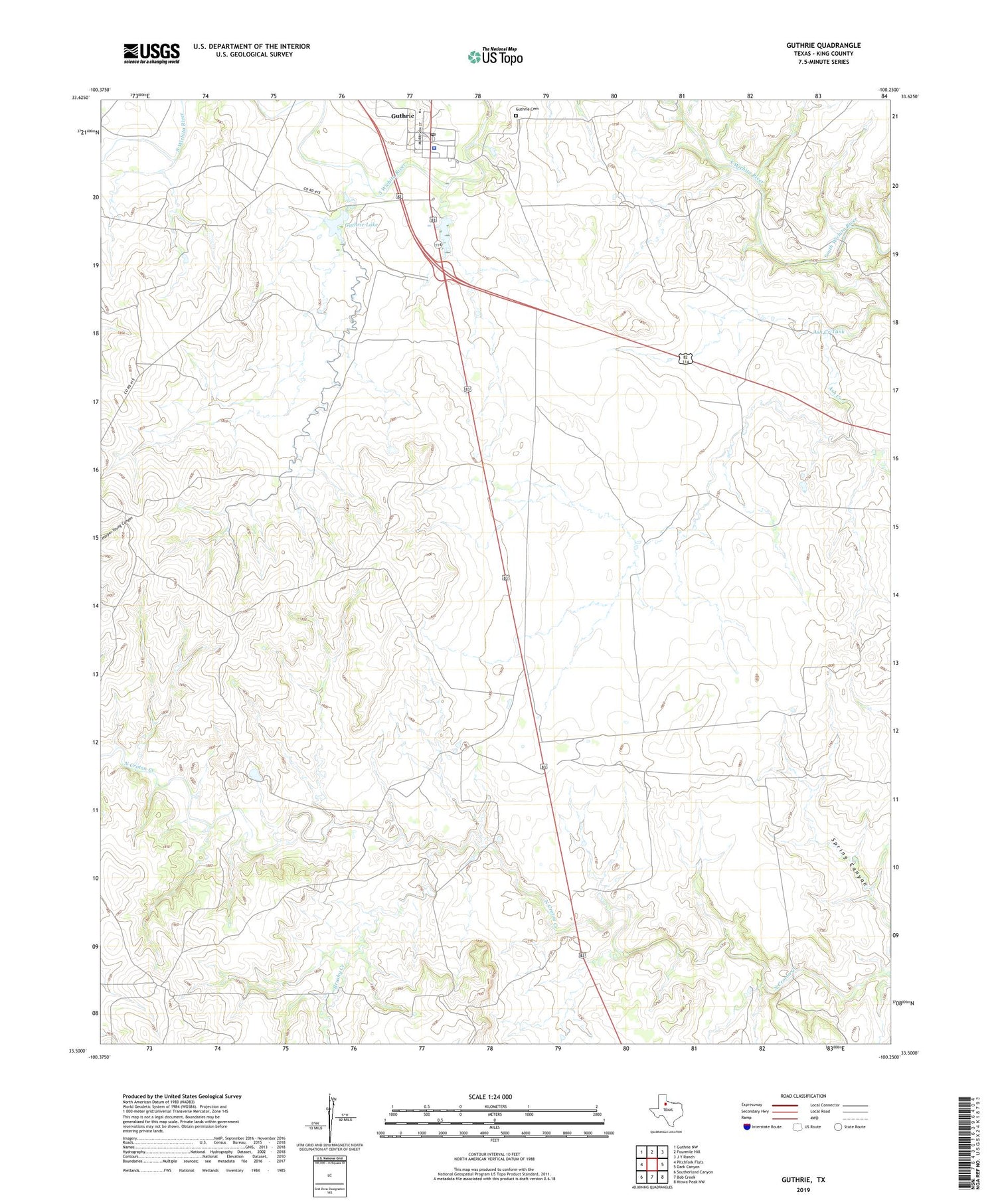
2019 topographic map quadrangle Guthrie in the state of Texas. Scale: 1:24000. Based on the newly updated USGS 7.5' US Topo map series, this map is in the following counties: King. The map contains contour data, water features, and other items you are used to seeing on USGS maps, but also has updated roads and other features. This is the next generation of topographic maps. Printed on high-quality waterproof paper with UV fade-resistant inks.
Quads adjacent to this one:
West: Pitchfork Flats
Northwest: Guthrie NW
North: Fourmile Hill
Northeast: J Y Ranch
East: Dark Canyon
Southeast: Kiowa Peak NW
South: Bob Creek
Southwest: Southerland Canyon
Contains the following named places: Ash Creek, Ash Creek Tank, Ash Creek Tank Dam, Ash Creek Windmill, Brushy Creek, Field Windmill, Guthrie, Guthrie Cemetery, Guthrie Census Designated Place, Guthrie Division, Guthrie Lake, Guthrie Lake Dam, Guthrie Post Office, King County, King County Emergency Medical Services, King County Jail, King County Sheriff's Office, Little River Windmill, Middle Field Windmill, Old Aspermont Highway Windmill, Old Wooden Town Windmill, Ralive Pen Windmill, Rock Pen Windmill, Salt Knobs Windmill, Spring Canyon Trap Windmill, Spring Canyon Windmill


