MyTopo
Dark Canyon Texas US Topo Map
Couldn't load pickup availability
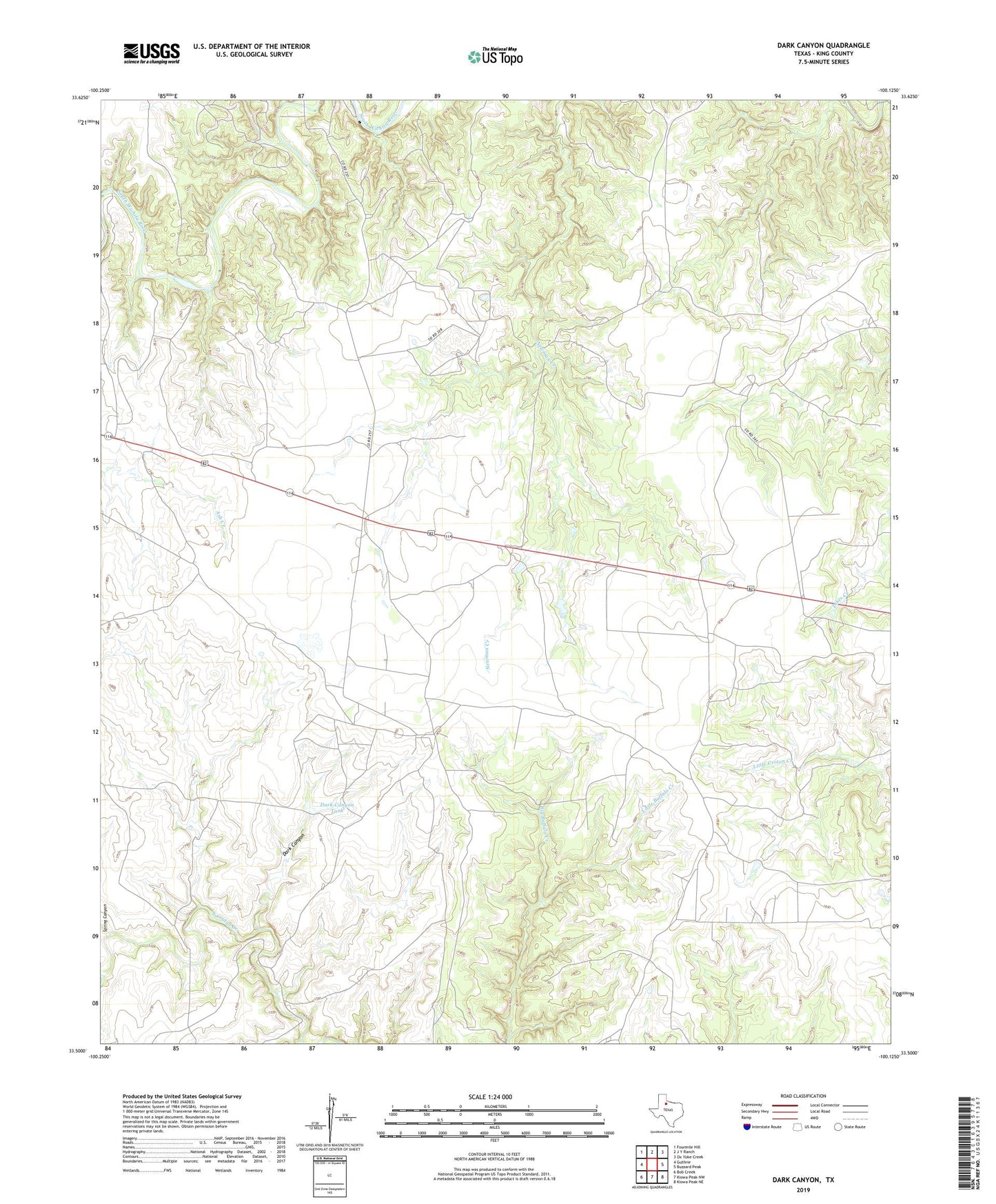
2022 topographic map quadrangle Dark Canyon in the state of Texas. Scale: 1:24000. Based on the newly updated USGS 7.5' US Topo map series, this map is in the following counties: King. The map contains contour data, water features, and other items you are used to seeing on USGS maps, but also has updated roads and other features. This is the next generation of topographic maps. Printed on high-quality waterproof paper with UV fade-resistant inks.
Quads adjacent to this one:
West: Guthrie
Northwest: Fourmile Hill
North: J Y Ranch
Northeast: Ox Yoke Creek
East: Buzzard Peak
Southeast: Kiowa Peak NE
South: Kiowa Peak NW
Southwest: Bob Creek
This map covers the same area as the classic USGS quad with code o33100e2.
Contains the following named places: Ash Windmill, Bateman Ranch, Boji Windmill, Dark Canyon, Dark Canyon Tank, Eight Camp, Little Buffalo Creek, Lobo Windmill, Pickett Pens, Spring Canyon