MyTopo
Hackberry Crossing Texas US Topo Map
Couldn't load pickup availability
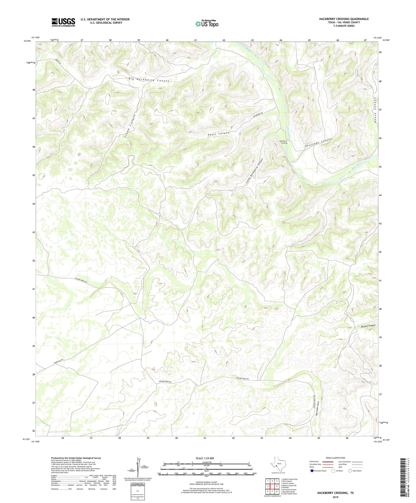
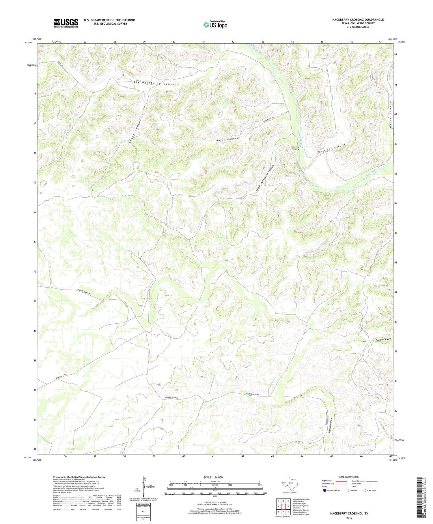
2019 topographic map quadrangle Hackberry Crossing in the state of Texas. Scale: 1:24000. Based on the newly updated USGS 7.5' US Topo map series, this map is in the following counties: Val Verde. The map contains contour data, water features, and other items you are used to seeing on USGS maps, but also has updated roads and other features. This is the next generation of topographic maps. Printed on high-quality waterproof paper with UV fade-resistant inks.
Quads adjacent to this one:
West: Meyers Canyon NE
Northwest: Geddis Canyon East
North: Post Canyon
Northeast: Antone Canyon
East: Pandale
Southeast: Little Fielder Draw
South: Roundhill Ranch
Southwest: Sevenmile Canyon
Contains the following named places: Big Hackberry Canyon, Davis Canyon, Hackberry Crossing, House Canyon, Little Hackberry Canyon, Stapp Canyon, Tanislado Canyon