MyTopo
Little Fielder Draw Texas US Topo Map
Couldn't load pickup availability
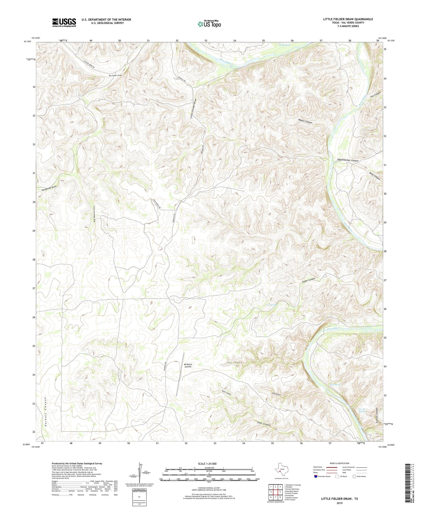
2022 topographic map quadrangle Little Fielder Draw in the state of Texas. Scale: 1:24000. Based on the newly updated USGS 7.5' US Topo map series, this map is in the following counties: Val Verde. The map contains contour data, water features, and other items you are used to seeing on USGS maps, but also has updated roads and other features. This is the next generation of topographic maps. Printed on high-quality waterproof paper with UV fade-resistant inks.
Quads adjacent to this one:
West: Roundhill Ranch
Northwest: Hackberry Crossing
North: Pandale
Northeast: Divide Well Draw
East: Everett Canyon
Southeast: Still Canyon
South: Harkell Canyon
Southwest: Pumpville
This map covers the same area as the classic USGS quad with code o30101a5.
Contains the following named places: 4M Ranch Airfield, Cash Ranch, Cox Springs, Deep Canyon, Everett Canyon, Everett Springs, Fox Canyon, Henderson Draw, Hog Canyon, Little Fielder Draw, Mule Canyon, Oppenheimer Canyon, Oso Canyon, Scott Spring, Tardy Spring, Wagon Canyon, White Ranch, Wolf Waterhole Draw