
MyTopo
Half Moon Prairie Texas US Topo Map
Couldn't load pickup availability
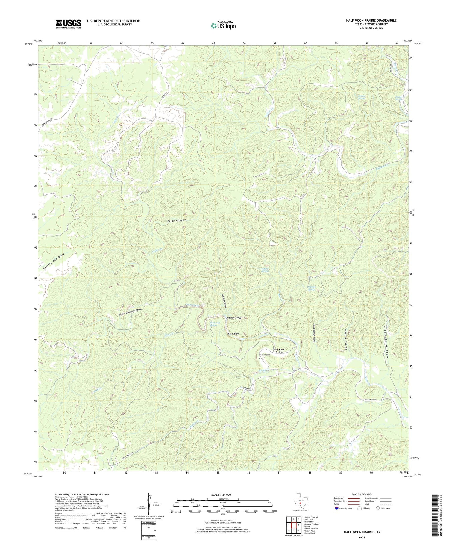
2019 topographic map quadrangle Half Moon Prairie in the state of Texas. Scale: 1:24000. Based on the newly updated USGS 7.5' US Topo map series, this map is in the following counties: Edwards. The map contains contour data, water features, and other items you are used to seeing on USGS maps, but also has updated roads and other features. This is the next generation of topographic maps. Printed on high-quality waterproof paper with UV fade-resistant inks.
Quads adjacent to this one:
West: Cutting Pen Draw
Northwest: Indian Creek NE
North: Cub Lake
Northeast: Hackberry
East: Vance
Southeast: Camp Wood
South: Kelley Peak
Southwest: Indian Mountain
Contains the following named places: Black Stump Draw, Blue Creek, Cedar Creek School, Coalson Cemetery, Deep Creek, Dripping Springs, Fern Bluff, Half Moon Prairie, Jade Lake, Little Blue Hole, Mitchell Hollow, Paint Bluff Springs, Painted Bluff, Polecat Spring, Pulliam Springs, Roberts Springs, Slide Canyon, Spring Creek, Spring Hollow, White Mountain Draw, Wildcat Draw


